
IMAGES TAKEN NEAR TO
Saffron Walk, BOURNE, PE10 9NR
Introduction
This page details the photographs taken nearby to Saffron Walk, PE10 9NR by members of the Geograph project.
The Geograph project started in 2005 with the aim of publishing, organising and preserving representative images for every square kilometre of Great Britain, Ireland and the Isle of Man.

There are currently over 7.5m images from over14,400 individuals and you can help contribute to the project by visiting https://www.geograph.org.uk
Image Map
Images are licensed for reuse under creativecommons.org/licenses/by-sa/2.0
Notes
- Clicking on the map will re-center to the selected point.
- The higher the marker number, the further away the image location is from the centre of the postcode.
Image Listing (668 Images Found)
Images are licensed for reuse under creativecommons.org/licenses/by-sa/2.0
Image
Details
Distance
1

Destruction
The laurel hedges on this estate had been left to overgrow, and a contractor was called in to cut them back, with this rather bleak result.
Image: © Bob Harvey
Taken: 22 Oct 2016
0.01 miles
2

Saffron walk at dusk
This is the old footpath that once led through the Glasshouses in the middle of town, where salad crops were grown. The stream seen in Image and Image is culverted below the path, and can oftimes be heard rushing under the manhole covers.
Image: © Bob Harvey
Taken: 21 May 2020
0.02 miles
3
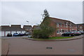
The effect of Politics
This estate was planned and built under the planning rules introduced by John Prescott when he ran a super-environment ministry as the Office of the Deputy Prime Minister.
Part of the regulation replaced the previous maximum housing density of around 25 dwellings per hectare with a new minimum density of 31 per hectare; hence the many three-storey houses on the estate. Another requirement was that 25% of houses be built without provision for parking a car. While this may have had a useful social engineering function in metropolitan areas like Hull, encouraging the use of public transport, in a small market town like Bourne it would have been a disaster.
The solution was to build separately, and sell separately, lock-up garages not attached to houses. They could even count separately toward the density calculation, if described carefully. These houses were also sold with a grassed front lawn, but as you can see, that vanished very quickly.
Image: © Bob Harvey
Taken: 19 Oct 2013
0.02 miles
4

Entrance to the estate
The only vehicular access to this estate is the road on the left.
Image: © Bob Harvey
Taken: 8 Oct 2013
0.02 miles
5
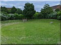
Rainwater sump
A feature of modern housing developments is the surface water run-off reservoir, which is supposed to limit flash flooding. This one is dry for most of the year, but the culvert on the far side gives the game away.
Image: © Bob Harvey
Taken: 9 Jun 2021
0.03 miles
6

Run-off lagoon
Housing estates in low-lying areas have to manage their own flood risk these days. This shallow depression - grassed as a play area - doubles as a relief for flash flooding.
Image: © Bob Harvey
Taken: 8 Oct 2013
0.03 miles
7

Sunken lawn
A grass-lined depression that can also act as a collection pool for run-off water, hidden among bushes in the centre of the estate.
Image: © Bob Harvey
Taken: 8 Oct 2013
0.03 miles
8
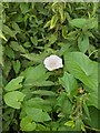
Calystegia sepium
Hedge Bindweed, or Bellbind, is familiar on this housing estate. The land was previously Ted Moody's market garden, and as production ceased whole greenhouses were smothered in Bindweed. It survives, as a spectacular flowering addition to hedges and shrubs among the houses.
Image: © Bob Harvey
Taken: 23 Jul 2021
0.03 miles
9

Private drive?
A little pseudo-crescent in Thyme Avenue, with a shared access to the front of the houses.
Image: © Bob Harvey
Taken: 19 Oct 2013
0.03 miles
10

The rear of Fort Sainsbury
The unnecessary walls of the supermarket delivery area (Image]) Loom over these unfortunate gardens
Image: © Bob Harvey
Taken: 19 Oct 2013
0.03 miles