
IMAGES TAKEN NEAR TO
Drummond Road, BOURNE, PE10 9JF
Introduction
This page details the photographs taken nearby to Drummond Road, PE10 9JF by members of the Geograph project.
The Geograph project started in 2005 with the aim of publishing, organising and preserving representative images for every square kilometre of Great Britain, Ireland and the Isle of Man.

There are currently over 7.5m images from over14,400 individuals and you can help contribute to the project by visiting https://www.geograph.org.uk
Image Map
Images are licensed for reuse under creativecommons.org/licenses/by-sa/2.0
Notes
- Clicking on the map will re-center to the selected point.
- The higher the marker number, the further away the image location is from the centre of the postcode.
Image Listing (143 Images Found)
Images are licensed for reuse under creativecommons.org/licenses/by-sa/2.0
Image
Details
Distance
1
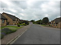
Heathcote Road
A short culdesac built in the late 1980s on former farm land near the railway.
The Heathcote family were Barons of Aveland in the 18th and 19th century, and married into the Willoughby de Eresby family of Grimsthorpe. The family were landowners in Bourne and the surrounding area, and benefactors to the town and to the Bourne Urban District Council, to whom they donated land for the town's council houses.
Image: © Bob Harvey
Taken: 17 Jun 2014
0.04 miles
2

Footpath between Drumond and Heathcote roads
Drummond Road was named after Dugald Drummond, a scots railway engineer of the 19th century.
Image: © Bob Harvey
Taken: 17 Jun 2014
0.05 miles
3

Parker Houses
Pair of houses by Parker Bros. of Spalding, with their characteristic large windows, tile-hung front, steel pipe porch and concrete gutters.
Image: © Bob Harvey
Taken: 17 Jun 2014
0.07 miles
4

Detached houses
A pair of detached houses. The one on the left is by Parker Brothers, from the 1960s, and the one on the right is around 15 years later.
Image: © Bob Harvey
Taken: 17 Jun 2014
0.07 miles

6

Oak Trees
Two fine oak trees in the garden of a 1990s house in South Road
Image: © Bob Harvey
Taken: 17 Jun 2014
0.09 miles
7

Commonwealth War Grave sign
Bourne cemetery has a new sign, announcing the presence of War Graves.
There is a list of 15 servicemen buried there at https://www.cwgc.org/find/find-war-dead/results/?cemetery=BOURNE%20CEMETERY
Image: © Bob Harvey
Taken: 5 Aug 2018
0.09 miles
8

Abundance
Trees and border plants in fine abundance next to South Road
Image: © Bob Harvey
Taken: 17 Jun 2014
0.09 miles
9

Cemetery lodge at Bourne, Lincolnshire
A perfectly serviceable stone lodge dating from the mid-19th century was demolished in 1960 to make way for this modern bungalow sited near the entrance in South Road, once the home of the cemetery supervisor but since the chapel closed in 2006 it has been used as an office and rest room for the ground staff. See also Image
Image: © Rex Needle
Taken: 8 Aug 2015
0.09 miles
10

Official flower tub
Bourne takes part in various "... in bloom" competitions, and this year has upped its game with these substantial sleeper-built wooden tubs on every road into town.
I say "into town". This one is on the old town boundary, not the newer southern one implied by the new bypass and the building of Elsea Park. Obviously some controversial decisions take time to be accepted. Perhaps there was nowhere to put it, despite a big old Roundabout and some wide verges.
Image: © Bob Harvey
Taken: 5 Aug 2018
0.10 miles