
IMAGES TAKEN NEAR TO
Pinfold Road, BOURNE, PE10 9HT
Introduction
This page details the photographs taken nearby to Pinfold Road, PE10 9HT by members of the Geograph project.
The Geograph project started in 2005 with the aim of publishing, organising and preserving representative images for every square kilometre of Great Britain, Ireland and the Isle of Man.

There are currently over 7.5m images from over14,400 individuals and you can help contribute to the project by visiting https://www.geograph.org.uk
Image Map
Images are licensed for reuse under creativecommons.org/licenses/by-sa/2.0
Notes
- Clicking on the map will re-center to the selected point.
- The higher the marker number, the further away the image location is from the centre of the postcode.
Image Listing (38 Images Found)
Images are licensed for reuse under creativecommons.org/licenses/by-sa/2.0
Image
Details
Distance
1
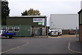
Woolf's Garage
Small but wery well thought of motor repairers, with a long history in the town.
Image: © Bob Harvey
Taken: 7 Oct 2013
0.06 miles
2

Camberwood Road
Small private road to the rear of the industrial units, named after the first business on the premises.
Image: © Bob Harvey
Taken: 7 Oct 2013
0.08 miles
3
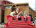
Unwanted cuddly toys in the waste centre at Bourne, Lincolnshire
The variety of unwanted items dumped at the household waste recycling centre in Pinfold Lane is unending but these cuddly toys which were abandoned in the skips were too good to be destroyed and so staff rescued them and gave them a safe perch on one of the safety barriers from where they can welcome drivers in the queue of waiting cars. See also Image
Image: © Rex Needle
Taken: 22 Jun 2015
0.09 miles
4
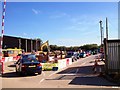
Waste recycling centre at Bourne, Lincolnshire
The bulk household waste recycling centre opened in Pinfold Lane in April 2002 to enable home owners dispose of unwanted rubbish too large for their wheelie bins but the original seven-day a week operation ended in 2012 because of public spending cuts by Lincolnshire County Council and opening confined to 9 am to 4 pm Friday to Monday.
Image: © Rex Needle
Taken: 29 Sep 2013
0.09 miles
5

Berries in Manning Road
This industrial road out of town to the east flanks the Car Dyke and is pleasantly lined with trees. There is an impressive flush of brightly coloured berries at this time of year.
Image: © Bob Harvey
Taken: 7 Oct 2013
0.09 miles
6

Home Decorating Centre
Stringers is a local family business who used to have a paint shop in the middle of town. The moved here, and re-styled the retail operation as "Home Decorating Centre", retaining the "Stringers" name for contract painting work.
The premises close in March at the start of the Covid-19 shutdown, but the contractors are still working, and they offer a call-and-collect retail operation which allows some level of sales without any human contact at all. The painted sheet reads "car park closed" and the notice next to the gate says they are open for collection only, and asks you to telephone to order.
Image: © Bob Harvey
Taken: 1 Jun 2020
0.09 miles
7

The last field
An undeveloped plot of land in the edge of town.
Image: © Bob Harvey
Taken: 7 Oct 2013
0.10 miles
8
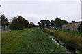
Car Dyke diversion, looking east
The Roman Car Dyke was diverted to the east of the town in the 20th century, when it was found that the flow via the Eau at Queens Bridge was inadequate.
Image: © Bob Harvey
Taken: 7 Oct 2013
0.10 miles
9

Recycling
The town waited 25 years for LCC to open a tip (we have to call them recycling centres now, though frankly the re-use of beer and milk bottles and the re-use of cardboard boxes in the 1950s was far less ecologically damaging). It is run on the council's behalf by a local contractor and tool hire company. Recent council cuts mean it is now only open 4 days a week.
The row of poplars is a traditional windbreak technique on the fen.
Image: © Bob Harvey
Taken: 21 Dec 2012
0.10 miles
10
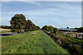
Car Dyke deviation
20th century diversion to Roman drainage system.
Image: © Bob Harvey
Taken: 7 Oct 2013
0.10 miles