
IMAGES TAKEN NEAR TO
Edinburgh Crescent, BOURNE, PE10 9DU
Introduction
This page details the photographs taken nearby to Edinburgh Crescent, PE10 9DU by members of the Geograph project.
The Geograph project started in 2005 with the aim of publishing, organising and preserving representative images for every square kilometre of Great Britain, Ireland and the Isle of Man.

There are currently over 7.5m images from over14,400 individuals and you can help contribute to the project by visiting https://www.geograph.org.uk
Image Map
Images are licensed for reuse under creativecommons.org/licenses/by-sa/2.0
Notes
- Clicking on the map will re-center to the selected point.
- The higher the marker number, the further away the image location is from the centre of the postcode.
Image Listing (57 Images Found)
Images are licensed for reuse under creativecommons.org/licenses/by-sa/2.0
Image
Details
Distance
1

Housing estate
Houses built by Bourne Urban District Council, most now privately owned.
Image: © Bob Harvey
Taken: 23 Feb 2014
0.04 miles
2

Edinburgh Crescent at Bourne, Lincolnshire
The residential area built on farmland to the north east of Bourne as part of the housing boom following the Second World War brought extra streets and roads to the town. Queen's Road was under construction with Edinburgh Crescent adjoining in 1953, the year that Queen Elizabeth II was crowned in the company of her consort, the Duke of Edinburgh, and so the two names reflected this national celebration.
Image: © Rex Needle
Taken: 2 Jun 2009
0.04 miles
3

Cherry blossom in Queen?s Road, Bourne, Lincolnshire
The residential areas built on farmland to the north east of Bourne as part of the housing boom following the Second World War were planted with ornamental trees along the verges such as this flowering cherry in Queen's Road which was under construction in 1953, the year that Queen Elizabeth II was crowned and so the name reflected this national celebration.
Image: © Rex Needle
Taken: 2 Jun 2009
0.06 miles

5

Parker houses
Substantially unmodified, these have the characteristic steel pipe porch and concrete gutters of the Parker houses also built in the Westwood estate
Image: © Bob Harvey
Taken: 23 Feb 2014
0.06 miles
6

Parker Houses
A small estate of Parker Houses built on former farm land adjacent to Mill Drove
Image: © Bob Harvey
Taken: 23 Feb 2014
0.07 miles
7

Bourne Academy at Bourne, Lincolnshire
This school has evolved through several stages during the advancement of secondary education in Bourne which began in Abbey Road in the 19th century. The present site in Edinburgh Crescent was acquired during a move to temporary buildings in 1946 and a continued programme of construction, improved facilities, increased staffing levels and name changes have created this modern educational complex known since October 2011 as Bourne Academy.
Image: © Rex Needle
Taken: 11 Sep 2011
0.07 miles
8
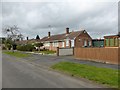
Parker bungalows
More mid-60s bungalows from Parker's. These are probably the only semi-detached bungalows they built.
Image: © Bob Harvey
Taken: 23 Feb 2014
0.07 miles
9
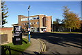
Beware of pedestrians
This is the 1960s central building and school hall of what used to be the Robert Manning school, and is now the Bourne Academy.
According to the sign, the pedestrians can be dangerous. I do hope our language is taught a little better inside.
Image: © Bob Harvey
Taken: 10 Nov 2013
0.08 miles
10
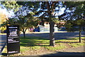
Bourne Academy
These buildings are rather newer than the ones in Image], being part of the expansion at the turn of the century
Image: © Bob Harvey
Taken: 10 Nov 2013
0.08 miles