
IMAGES TAKEN NEAR TO
Bramley Close, BOURNE, PE10 9BD
Introduction
This page details the photographs taken nearby to Bramley Close, PE10 9BD by members of the Geograph project.
The Geograph project started in 2005 with the aim of publishing, organising and preserving representative images for every square kilometre of Great Britain, Ireland and the Isle of Man.

There are currently over 7.5m images from over14,400 individuals and you can help contribute to the project by visiting https://www.geograph.org.uk
Image Map
Images are licensed for reuse under creativecommons.org/licenses/by-sa/2.0
Notes
- Clicking on the map will re-center to the selected point.
- The higher the marker number, the further away the image location is from the centre of the postcode.
Image Listing (278 Images Found)
Images are licensed for reuse under creativecommons.org/licenses/by-sa/2.0
Image
Details
Distance
1
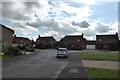
Arched, Square, round, round again
In the centre of each of these houses is a specifically shaped window. On the left is a stairwell light with an arched top, then across the end of Bramley close there are houses with bathroom windows in square and round format.
Arched window? Square window? round window? Does anyone remember Derek Griffiths and Play School?
or am I being daft?
Image: © Bob Harvey
Taken: 8 Oct 2013
0.02 miles
2

Speed bumps at Bourne, Lincolnshire
Traffic calming measures such as speed bumps are not popular with motorists because they have to slow down and it is widely believed that they can cause damage to the car but their use is now widespread in urban areas such as here in Beech Avenue, the town’s longest street plagued by drivers exceeding the speed limit, where they were introduced in 2009 amid much controversy.
Image: © Rex Needle
Taken: 22 Apr 2009
0.03 miles
3
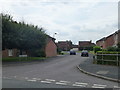
The old Orchard: Bramley Close
The plot of land at the end of Stanley Street was a former commercial orchard. In the late 1980s Beech Avenue was joined up with Stanley Street, and the area was redeveloped. The roads have been given names appropriate to the old land usage.
Image: © Bob Harvey
Taken: 7 Aug 2013
0.03 miles
4
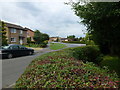
The end of Beech Avenue
The end of Beech Avenue, where it turns into St Gilberts Road.
This whole area was a commercial orchard in the early 20th century, lay fallow for a few decades, and was developed in the late 1980s
Believe it or not, there is a stream just inside the hedge in the foreground.
Image: © Bob Harvey
Taken: 7 Aug 2013
0.04 miles
5

Part of Saxon Way
This little cul-de-sac does not have a separate name. The houses are numbered as part of Saxon Way
Image: © Bob Harvey
Taken: 29 Jul 2014
0.05 miles
6

A highway fossil
The footpath alongside the stream in Christopher's Lane used to run all the way to Bourne Woods. It is, in law, a restricted byway (the main limitation being on the use of powered vehicles and horses).
Here is the sign at the Northern end of Christopher's Lane. The fingerboard pointing back over my right shoulder is along the narrow footpath. The other half is actually pointing along the estate road and footpath in the foreground (the original path was slightly diverted along the pavement of the road).
There cannot be many places where a pavement next to an estate road is separately defined as a restricted byway. This suggests that the Bureaucratic mind is not to be trifled with.
Image: © Bob Harvey
Taken: 7 Aug 2013
0.05 miles
7

The old Orchard: Orchard Close
The plot of land at the end of Stanley Street was a former commercial orchard. In the late 1980s Beech Avenue was joined up with Stanley Street, and the area was redeveloped. The roads have been given names appropriate to the old land usage.
Image: © Bob Harvey
Taken: 7 Aug 2013
0.05 miles
8
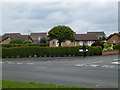
End of Stanley Street
Bungalows at the end of Stanley Street
When the old Orchard was being redeveloped, these two bungalows ended up with a stream in the garden.
Image: © Bob Harvey
Taken: 7 Aug 2013
0.05 miles
9

Footpath from Christopher's Lane - Northern end
This is the Restricted Byway from the end of the paved road of Christopher's Lane to Orchard Close. I am not sure why officialdom has banned motor vehicles and horses from here, I cannot imagine either of them fitting in!
There is a stream hidden in the undergrowth on the right.
The track here has a gravel surface.
Image: © Bob Harvey
Taken: 7 Aug 2013
0.05 miles
10

Sculpture and Stream
This is one of two houses built at the end of Stanley Street which include the stream to Christopher's Lane in their garden.
Image: © Bob Harvey
Taken: 7 Aug 2013
0.06 miles