
IMAGES TAKEN NEAR TO
Notley Way, PE10 2BG
Introduction
This page details the photographs taken nearby to Notley Way, PE10 2BG by members of the Geograph project.
The Geograph project started in 2005 with the aim of publishing, organising and preserving representative images for every square kilometre of Great Britain, Ireland and the Isle of Man.

There are currently over 7.5m images from over14,400 individuals and you can help contribute to the project by visiting https://www.geograph.org.uk
Image Map
Images are licensed for reuse under creativecommons.org/licenses/by-sa/2.0
Notes
- Clicking on the map will re-center to the selected point.
- The higher the marker number, the further away the image location is from the centre of the postcode.
Image Listing (15 Images Found)
Images are licensed for reuse under creativecommons.org/licenses/by-sa/2.0
Image
Details
Distance
1
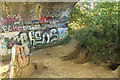
Underneath the arches
Rabbit burrows and graffiti under the disused railway bridge http://www.geograph.org.uk/photo/3623513
Image: © Richard Croft
Taken: 27 Aug 2013
0.07 miles
2
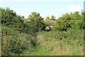
Disused railway bridge
Trackbed and disused bridge over the former Midland and Great Northern line between Bourne and Little Bytham
Image: © Richard Croft
Taken: 27 Aug 2013
0.07 miles
3
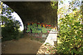
Underneath the arches
Graffiti under the central span of the disused railway bridge http://www.geograph.org.uk/photo/3623513
Image: © Richard Croft
Taken: 27 Aug 2013
0.07 miles
4
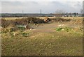
Derelict Land, Bourne
This patch of concrete and brambles used to be a Piggery according to the Ordnance Survey map.
Image: © Tony Atkin
Taken: 26 Dec 2005
0.13 miles
5
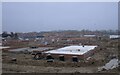
Housing to come
The slabs laid out for another tranche of the Elsea Park development, that is more than doubling the number of homes in the town.
Image: © Bob Harvey
Taken: 23 Dec 2021
0.13 miles
6
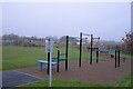
Adult playground
All is not what it seems here. This is not exactly a children's playground. Take a look at Image
Image: © Bob Harvey
Taken: 23 Dec 2021
0.14 miles
7
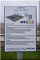
Exercise instructions
Notice for the equipment at Image
Note that it says "for youth and adults or having an overall height greater than 1.4m only".
Image: © Bob Harvey
Taken: 23 Dec 2021
0.14 miles
8
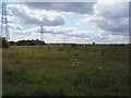
Field south of Bourne Castle earthworks
A field viewed from a public footpath to the south of Bourne's castle earthworks.
Image: © Ajay Tegala
Taken: 7 Jun 2011
0.14 miles
9
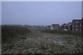
A break in the housing
A possible gap in the spread of housing in Elsea Park.
Image: © Bob Harvey
Taken: 23 Dec 2021
0.15 miles
10
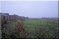
A gap in the housing
It looks a bit like this strip of land will not be built on. Or, at least, not yet.
Image: © Bob Harvey
Taken: 23 Dec 2021
0.15 miles