
IMAGES TAKEN NEAR TO
Nene Close, BOURNE, PE10 0YN
Introduction
This page details the photographs taken nearby to Nene Close, PE10 0YN by members of the Geograph project.
The Geograph project started in 2005 with the aim of publishing, organising and preserving representative images for every square kilometre of Great Britain, Ireland and the Isle of Man.

There are currently over 7.5m images from over14,400 individuals and you can help contribute to the project by visiting https://www.geograph.org.uk
Image Map
Images are licensed for reuse under creativecommons.org/licenses/by-sa/2.0
Notes
- Clicking on the map will re-center to the selected point.
- The higher the marker number, the further away the image location is from the centre of the postcode.
Image Listing (199 Images Found)
Images are licensed for reuse under creativecommons.org/licenses/by-sa/2.0
Image
Details
Distance

2
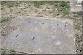
A cluster of manholes
A rare old selection of manholes that are part of the Gas installation seen in Image
Image: © Bob Harvey
Taken: 24 May 2020
0.02 miles
3

Drum house
There is a house either side of the estate entrance with this hint of the castle about them.
Image: © Bob Harvey
Taken: 24 May 2020
0.03 miles
4
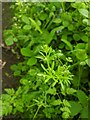
Galium aparine
Cleavers, Goose Grass, Bedstraw - call it what you will it is everywhere in the undergrowth.
But when it flowers it does so with the tiniest of white four-petaled flowers. They are so small that you have to wonder what pollinates them. The answer appears to be "tiny flies and smaller beetles".
Image: © Bob Harvey
Taken: 17 May 2020
0.03 miles
5

Back to front house
Here is a rum thing. Quite a rum thing. A very rum thing indeed.
What looks like the ceremonial front of this house has no vehicular access, and only a late-built lightly paved path that connects directly with the road, a road without lateral footpath at this point.
This is, splendidly, the back of this house. It has a small garden by the frontage (is there such a word as backage?), and the main access is on the other side as part of Welland Drive. Now, all this is my supposition. I am sure the inhabitant is free to regard either entrance as the back or the front door, so the idea that this is the back may be abhorrent to the owner. In which case I apologise for the presumption necessary to tell what I think an interesting tale. I enjoy eccentricity, and to find it on a routine housing estate is a joy.
Image: © Bob Harvey
Taken: 24 May 2020
0.03 miles
6
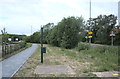
Gas installation and footpath
The footpath seen starting in Image goes past this collection of manholes and a pole-mounted device which are all part of the mains gas gubbinsry on the edge of town.
Image: © Bob Harvey
Taken: 24 May 2020
0.03 miles
7

Gas vent and sampling point
Part of the collection of weird gubbins seen in Image I am no expert on Gas, but there is no electrical supply here, which is reassuring. The cabinet is designed to be opened, so I imagine there is some recording instrument, paper betrayal filter, or similar integration device inside. All the other bits and pieces are below ground.
Image: © Bob Harvey
Taken: 24 May 2020
0.03 miles
8

A sheltered path
This gravelled path gives foot access to West Road from Welland Drive. West Road is behind the hedge on the left.
See Image for a contrary view direction.
Image: © Bob Harvey
Taken: 24 May 2020
0.03 miles
9
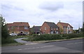
Access by foot
There is no pavement provide by the highway authorities on the south side of West Road, beyond Westwood Drive. (see Image) When the estate at Welland Drive was laid out it was clear that they would need pedestrian access to the town, for schools and the like.
The solution was to install a crossing from the North side of West Road, where there is a maintained pavement as far as the bottom of Stamford Hill, and a footpath link from there to the new estate roads.
The link can be seen in Image and Image
Image: © Bob Harvey
Taken: 24 May 2020
0.03 miles
10
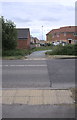
The crossing
This is the footpath crossing seen also in Image You will have deduced that the housebuilders were too tight to subsidise a zebra crossing, and are leaving that responsibility to the community after they are gone.
Image: © Bob Harvey
Taken: 24 May 2020
0.03 miles