
IMAGES TAKEN NEAR TO
Fontwell Park Drive, BOURNE, PE10 0YE
Introduction
This page details the photographs taken nearby to Fontwell Park Drive, PE10 0YE by members of the Geograph project.
The Geograph project started in 2005 with the aim of publishing, organising and preserving representative images for every square kilometre of Great Britain, Ireland and the Isle of Man.

There are currently over 7.5m images from over14,400 individuals and you can help contribute to the project by visiting https://www.geograph.org.uk
Image Map
Images are licensed for reuse under creativecommons.org/licenses/by-sa/2.0
Notes
- Clicking on the map will re-center to the selected point.
- The higher the marker number, the further away the image location is from the centre of the postcode.
Image Listing (50 Images Found)
Images are licensed for reuse under creativecommons.org/licenses/by-sa/2.0
Image
Details
Distance
1

Musselburgh Way, Bourne
Typical cramped modern estate.
Image: © Jonathan Thacker
Taken: 31 Dec 2021
0.06 miles

3

Rainbow in the window
The "rainbow of hope" of Image
Image: © Bob Harvey
Taken: 24 May 2020
0.07 miles
4

Detached house
One of the new houses on Oak Spring place, with a pandemic "rainbow of hope" in the window
Image: © Bob Harvey
Taken: 24 May 2020
0.07 miles
5

Cruising around
We were during a lockdown, when only essential trades and shoppers were about. This chap was taking his cement mixer for a ride. He cruised this estate and came back again, and I saw him elsewhere.
The sensible explanation is that he was trying to deliver elsewhere on the estate, but there are as yet no through roads and he was struggling to reach a destination. But sensible answers are no fun.
Image: © Bob Harvey
Taken: 24 May 2020
0.08 miles
6
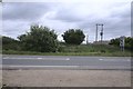
No sign of the railway
Looking the other way from Image, toward the former station in Bourne, there is nothing to show this was once a trackbed. The road in the foreground is the A151 Bourne Bypass
Image: © Bob Harvey
Taken: 24 May 2020
0.08 miles
7

Telecoms infrastructure
Connection cabinet and manhole covers for the telephone and internet installation. This cabinet has lovures, so it obviously has power, which means it is a "fibre to the cabinet" termination.
Note too the tactile pavement.
Image: © Bob Harvey
Taken: 24 May 2020
0.08 miles

9
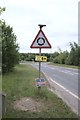
Bypass roundabout sign
also with surface water drain cover, and LCC boundary post
Image: © Bob Harvey
Taken: 24 May 2020
0.08 miles
10

Emergency signage
During the Coronavirus shutdown, the Co-op (Image) was open as an essential foodstore but had put in place precautions like an internal one-way system to enforce social distancing (Image). This notice in the window reads:
"We might limit the amount of customers in the store at any one time
If you have to wait outside, be a hero and please stay 2m (6ft) away from other people".
Image: © Bob Harvey
Taken: 24 May 2020
0.08 miles