
IMAGES TAKEN NEAR TO
Brambling Walk, BOURNE, PE10 0WB
Introduction
This page details the photographs taken nearby to Brambling Walk, PE10 0WB by members of the Geograph project.
The Geograph project started in 2005 with the aim of publishing, organising and preserving representative images for every square kilometre of Great Britain, Ireland and the Isle of Man.

There are currently over 7.5m images from over14,400 individuals and you can help contribute to the project by visiting https://www.geograph.org.uk
Image Map
Images are licensed for reuse under creativecommons.org/licenses/by-sa/2.0
Notes
- Clicking on the map will re-center to the selected point.
- The higher the marker number, the further away the image location is from the centre of the postcode.
Image Listing (18 Images Found)
Images are licensed for reuse under creativecommons.org/licenses/by-sa/2.0
Image
Details
Distance
1

The old Methodist chapel at Rippingale, near Bourne, Lincolnshire
The first Methodist chapel was erected here in 1832 and replaced by this larger one in 1935 at a cost of £1,050 but the building was closed because of subsidence in 2004 when it was demolished and the site has since been used for new houses.
Image: © Rex Needle
Taken: 10 Jun 1999
0.07 miles
2
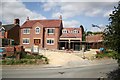
New House
A new house on the former site of the Methodist Chapel http://www.geograph.org.uk/photo/364901 http://www.geograph.org.uk/photo/90701
Image: © Richard Croft
Taken: 9 Aug 2007
0.09 miles
3
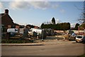
Building Site
New building on the site of the Wesleyan Chapel http://www.geograph.org.uk/photo/90701
Image: © Richard Croft
Taken: 13 Mar 2007
0.09 miles
4

Transformation complete
New house awaiting new owners on the site of Rippingale Methodist Chapel http://www.geograph.org.uk/photo/90701 http://www.geograph.org.uk/photo/364901 http://www.geograph.org.uk/photo/525604
Image: © Richard Croft
Taken: 25 Sep 2008
0.09 miles
5

Council houses at Rippingale, near Bourne, Lincolnshire
Rows of council houses are to be found in most of our villages although many have now been sold to sitting tenants such as here in Station Street where this terrace of solid Victorian homes typical of the late 19th century has been given a new tiled roof to replace the original blue slate while the public seat at the roadside is a welcome amenity for passing pensioners.
Image: © Rex Needle
Taken: 13 Sep 2001
0.11 miles
6
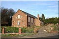
Methodist Chapel
Disused, derelict and vandalised, Rippingale Methodist Chapel viewed from the Pinfold.
Image: © Richard Croft
Taken: Unknown
0.11 miles
7

Rippingale Pinfold
There has been a pinfold here since the 12th century - restored by Community Enterprise Projects 1984
Image: © Richard Croft
Taken: 13 Mar 2007
0.12 miles

9

Old Direction Sign - Signpost by Station Street, Rippingale
Ball finial - 3 arms; by the UC road, in parish of Rippingale (South Kesteven District), junction of Station Street with Middle Street, on verge, North side of road.
Surveyed
Milestone Society National ID: LI_TF0928
Image: © Milestone Society
Taken: Unknown
0.18 miles
10

The junction of Station Street and Middle Street, Rippingale, Lincolnshire
Rippingale is an attractive village, just east of the A15, 5 miles north of Bourne.
Station Street runs from east (left) to west (right) through the whole village.
Middle street runs southwards from Station Street to East Street.
Image: © Mike Maughan
Taken: 9 Sep 2024
0.19 miles