
IMAGES TAKEN NEAR TO
Fen Road, BOURNE, PE10 0TR
Introduction
This page details the photographs taken nearby to Fen Road, PE10 0TR by members of the Geograph project.
The Geograph project started in 2005 with the aim of publishing, organising and preserving representative images for every square kilometre of Great Britain, Ireland and the Isle of Man.

There are currently over 7.5m images from over14,400 individuals and you can help contribute to the project by visiting https://www.geograph.org.uk
Image Map
Images are licensed for reuse under creativecommons.org/licenses/by-sa/2.0
Notes
- Clicking on the map will re-center to the selected point.
- The higher the marker number, the further away the image location is from the centre of the postcode.
Image Listing (22 Images Found)
Images are licensed for reuse under creativecommons.org/licenses/by-sa/2.0
Image
Details
Distance

2

George VI postbox on Main Road, Dowsby
Postbox No. PE10 224.
See Image] for context.
Image: © JThomas
Taken: 2 Apr 2021
0.05 miles

4

Houses on Main Road, Dowsby
Showing position of Postbox No. PE10 224.
See Image] for postbox.
Image: © JThomas
Taken: 2 Apr 2021
0.06 miles

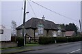
7

Lintel and datestone
The date of 1920 marks the start of work, the Hall opened in 1921.
The inscription reads
"Arthur W Dean gave Dowsby this hall
QA thanksgiving for peace after war
"Thynke and thanke God of all" "
Image: © Bob Harvey
Taken: 19 Dec 2021
0.08 miles
8

Defibrillator at the village hall
On the north side of the porch, complete with signage and instructions
Image: © Bob Harvey
Taken: 19 Dec 2021
0.08 miles

10

Road out of Dowsby towards Dowsby Fen
Each of the villages between Bourne and Heckington, a distance of some 15 miles, almost without exception has a road leading out onto the fen named after its village and terminating at the South Forty Foot Drain. These roads are often straight, apart from double-sharp bends to keep them heading in the same direction. The road eastwards out of Dowsby on to Dowsby Fen is an exception as it crosses the South Forty Foot Drain and continues on to Gosberton. This scene, just outside the village of Dowsby, is typical fenland. The most noticeable feature is often the skies as here. This was a day of sunshine and heavy showers - the clouds in the distance promise more rain.
Image: © Marathon
Taken: 4 Nov 2011
0.15 miles