
IMAGES TAKEN NEAR TO
Millers Close, BOURNE, PE10 0TH
Introduction
This page details the photographs taken nearby to Millers Close, PE10 0TH by members of the Geograph project.
The Geograph project started in 2005 with the aim of publishing, organising and preserving representative images for every square kilometre of Great Britain, Ireland and the Isle of Man.

There are currently over 7.5m images from over14,400 individuals and you can help contribute to the project by visiting https://www.geograph.org.uk
Image Map
Images are licensed for reuse under creativecommons.org/licenses/by-sa/2.0
Notes
- Clicking on the map will re-center to the selected point.
- The higher the marker number, the further away the image location is from the centre of the postcode.
Image Listing (18 Images Found)
Images are licensed for reuse under creativecommons.org/licenses/by-sa/2.0
Image
Details
Distance
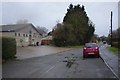
2
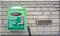
Defibrillator at the village hall
This is the defibrillator seen in Image
Image: © Bob Harvey
Taken: 3 Mar 2019
0.10 miles
3
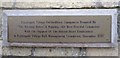
Dedicatory plaque
This accompanies Image
It reads "Rippingale Village Defibrillator equipment donated by "The Bunting Babes" & Ripping-Ae Beer Festival Committee with the support of the British Heart Foundation & Rippingale Village Hall Management Committee. December 2015"
Thus, like Folkingham, Rippingale is a village with two public access defibrillators. See Image
Image: © Bob Harvey
Taken: 3 Mar 2019
0.10 miles
4
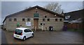
The front of the Village Hall
See Image for a close-up of the defibrillator on the wall
Image: © Bob Harvey
Taken: 3 Mar 2019
0.11 miles
5

Village recycling site
Collection point in the village hall car park
Image: © Bob Harvey
Taken: 3 Mar 2019
0.11 miles
6
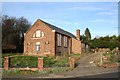
Methodist Chapel
Disused, derelict and vandalised, Rippingale Methodist Chapel viewed from the Pinfold.
Image: © Richard Croft
Taken: Unknown
0.12 miles
7

Rippingale Pinfold
There has been a pinfold here since the 12th century - restored by Community Enterprise Projects 1984
Image: © Richard Croft
Taken: 13 Mar 2007
0.12 miles
8

Gladstone Villas at Rippingale, near Bourne, Lincolnshire
A pair of red brick cottages was built in Station Street in 1869, the year after William Ewart Gladstone was elected prime minister for the first time, and so they were named after him and although much improved, they remain in useful occupation today. Gladstone was to serve three more terms between then and 1894 to become our greatest reforming statesman and there is now hardly a town in England without a street or building named after him.
Image: © Rex Needle
Taken: 18 Mar 2001
0.13 miles

10
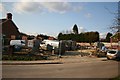
Building Site
New building on the site of the Wesleyan Chapel http://www.geograph.org.uk/photo/90701
Image: © Richard Croft
Taken: 13 Mar 2007
0.14 miles