
IMAGES TAKEN NEAR TO
The Kennels, BOURNE, PE10 0SB
Introduction
This page details the photographs taken nearby to The Kennels, PE10 0SB by members of the Geograph project.
The Geograph project started in 2005 with the aim of publishing, organising and preserving representative images for every square kilometre of Great Britain, Ireland and the Isle of Man.

There are currently over 7.5m images from over14,400 individuals and you can help contribute to the project by visiting https://www.geograph.org.uk
Image Map
Images are licensed for reuse under creativecommons.org/licenses/by-sa/2.0
Notes
- Clicking on the map will re-center to the selected point.
- The higher the marker number, the further away the image location is from the centre of the postcode.
Image Listing (22 Images Found)
Images are licensed for reuse under creativecommons.org/licenses/by-sa/2.0
Image
Details
Distance
1

Goose pond
The two or three geese being kept by this dried-up pond ran away when they saw the dogs, so they don't feature in the picture.
Image: © Bob Harvey
Taken: 3 Oct 2014
0.04 miles
2

Field edge
The width and depth of the furrow taken can be clearly seen here, and a splendid bit of plough control it is as well.
Image: © Bob Harvey
Taken: 3 Oct 2014
0.04 miles
3
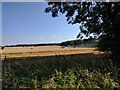
Combining
I heard the machine whilst walking the dogs, and headed over in the hope of a dramatic picture. But the dogs wanted to sniff things, and other doggy duties, so by the time I got to the edge of the wood the boundary cut had been taken and the combine was making long cuts across the middle of the field.
Image: © Bob Harvey
Taken: 17 Aug 2016
0.10 miles
4

In Callan's Lane Wood
This ancient woodland is part of the Kesteven Forest, see http://www.forestry.gov.uk/kestevenforest
Image: © Kate Jewell
Taken: 14 Jan 2007
0.15 miles
5

Across the fields
View toward Row Wood, Stainfield
Image: © Bob Harvey
Taken: 3 Oct 2014
0.16 miles
6
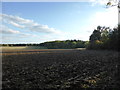
Field next to Callan's Lane Wood
Unusual to see proper ploughing these days. most fields are straw-incorporated, direct-drilled or just disc'd
Image: © Bob Harvey
Taken: 3 Oct 2014
0.18 miles
7

Footpath from Callan's Lane Wood to Kirkby Underwood
Heading towards the Church of St Mary and All Saints
Image: © Tim Heaton
Taken: 13 Apr 2021
0.19 miles

9

New woodland in Callan's Lane Wood
The Forestry Commission is managing this ancient woodland through more diverse planting. This newly restored area is protected by a high fence to keep out the deer. The fence is also buried in the ground to protect the young trees and shrubs from rabbits as well as providing a support for honeysuckle as well!
Image: © Kate Jewell
Taken: 18 Apr 2007
0.21 miles
10

St.Mary & All Saints' church, Kirkby Underwood, Lincs.
Slightly away from the village, up a narrow lane and surrounded by open farmland. Early English and Perpendicular.
Image: © Richard Croft
Taken: 13 Dec 2005
0.21 miles