
IMAGES TAKEN NEAR TO
Bourne Road, BOURNE, PE10 0RH
Introduction
This page details the photographs taken nearby to Bourne Road, PE10 0RH by members of the Geograph project.
The Geograph project started in 2005 with the aim of publishing, organising and preserving representative images for every square kilometre of Great Britain, Ireland and the Isle of Man.

There are currently over 7.5m images from over14,400 individuals and you can help contribute to the project by visiting https://www.geograph.org.uk
Image Map
Images are licensed for reuse under creativecommons.org/licenses/by-sa/2.0
Notes
- Clicking on the map will re-center to the selected point.
- The higher the marker number, the further away the image location is from the centre of the postcode.
Image Listing (27 Images Found)
Images are licensed for reuse under creativecommons.org/licenses/by-sa/2.0
Image
Details
Distance

2
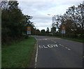
Entering Morton
Heading north on Bourne Road (A15).
Image: © JThomas
Taken: 26 Oct 2013
0.03 miles
3

Public footpath signs, near Morton
Two footpath signs: one points towards Morton, the other points southeast and links up with other footpaths - towards Dyke and Bourne. The white railings are to warn of a watercourse and culvert; similar railings are on the other side of the road - where the stream enters the culvert.
Image: © Brian Green
Taken: 29 Dec 2007
0.06 miles

5

Looking down on me
When I emerged from my walk I was faced with this sign, left over from the general election. This chap was re-elected, surprisingly.
Image: © Bob Harvey
Taken: 9 May 2015
0.08 miles
6

Parch markes in field at Bunkers Hill Farm, south of Morton: aerial 2020
Probably bare patches where the stock has been fed.
Ridge and furrow on east side of the road.
See also Image
Image: © Chris
Taken: 22 Mar 2020
0.10 miles
7

Footpath to nowhere
Part of a network of paths between Dyke and Morton with no apparent purpose. They lead to places were there were once isolated homesteads and common fields.
Image: © Bob Harvey
Taken: 9 May 2015
0.11 miles
8

After the harvest near Bourne, Lincolnshire
The hum of the combines can be heard throughout the Lincolnshire corn belt in high summer as the grain harvest is gathered in and once these mighty machines have departed the tractors and trailers take over to collect the straw. The big circular bales are now a familiar sight in the fields because their shape and larger size make them a more efficient storage medium and a convenient method of transporting around the farm. Here on the outskirts of Bourne, they now await collection for use in other farmyard activities during the year with the late afternoon sun giving the scene a golden glow.
Image: © Rex Needle
Taken: 28 Jul 1999
0.12 miles
9
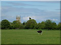
Beware of the Bull
There is a public footpath through this field, and a sign that says "beware of the Bull". He's a bit of a pussycat, but I would not walk through here with my dogs!
Image: © Bob Harvey
Taken: 9 May 2015
0.13 miles
10

Old Milestone, on the A15, Bourne Road
Opposite nursery. Located on the East side of road, on the verge. Metal plate attached to stone post, London Road iron plate design, erected by Lincoln Heath to Peterborough - North District turnpike trust, 19th century. Alternative views see http://www.geograph.org.uk/photo/2868920 & http://www.geograph.org.uk/photo/2868924 & http://www.geograph.org.uk/photo/643065
Inscription reads: // LONDON / 99 / BOURNE / 2 / MORTON
Grade II listed by Historic England.
Milestone Society National ID: LI_LO099
Image: © Milestone Society
Taken: Unknown
0.13 miles