
IMAGES TAKEN NEAR TO
Campion Way, BOURNE, PE10 0QE
Introduction
This page details the photographs taken nearby to Campion Way, PE10 0QE by members of the Geograph project.
The Geograph project started in 2005 with the aim of publishing, organising and preserving representative images for every square kilometre of Great Britain, Ireland and the Isle of Man.

There are currently over 7.5m images from over14,400 individuals and you can help contribute to the project by visiting https://www.geograph.org.uk
Image Map
Images are licensed for reuse under creativecommons.org/licenses/by-sa/2.0
Notes
- Clicking on the map will re-center to the selected point.
- The higher the marker number, the further away the image location is from the centre of the postcode.
Image Listing (75 Images Found)
Images are licensed for reuse under creativecommons.org/licenses/by-sa/2.0
Image
Details
Distance
1
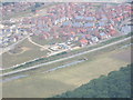
Elsea Park
An aerial photograph of Elsea Park taken in August 2005
Image: © Roger Callow
Taken: 9 Aug 2005
0.06 miles
2

Elsea Park
Part of the once-controversial Elsea Park estate, built by Larkfleet homes.
Image: © Bob Harvey
Taken: 16 Aug 2014
0.09 miles
3

House and Office
More and more people in Bourne work from home, but few put business signage on their homes.
Image: © Bob Harvey
Taken: 16 Aug 2014
0.11 miles
4

Quayside
A spurious name. There was never a quay here (although the location of the docks for the Roman Bourne-Morton canal is unknown). The water here is part of a mandatory flood control system disguised as a decorative pond. That said, with the lime trees and all, it looks nicer than I ever expected.
Image: © Bob Harvey
Taken: 16 Aug 2014
0.13 miles
5
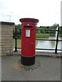
Pillar box
EIIR cipher on the pillar box on Quayside
Image: © Bob Harvey
Taken: 31 May 2017
0.13 miles
6

Datestone
The keystone of one arch of the causeway at Image carries the date 2001.
Image: © Bob Harvey
Taken: 31 May 2017
0.14 miles
7

Quayside West, Bourne
This new development is on the southern edge of Bourne, just inside the Ring Road. This view is from Tilia Way.
Image: © Marathon
Taken: 3 May 2013
0.15 miles

9

Tilia Way
The causeway over the flood water catchment pool into the housing estate at Elsea Park. Tilia is, of course, the Lime Tree, a Lincolnshire native. Several were cut down to build the road.
Image: © Bob Harvey
Taken: 31 May 2017
0.15 miles
10

The south-west relief road at Bourne, Lincolnshire
Traffic continues to choke many of our small market towns but a 1½-mile south-west relief road has been built in Bourne at a cost of £4 million as part of the planning gain by the developers in exchange for permission to build an estate of 2,000 houses. The new highway opened in 2005 and has eased vehicle flows through the town centre but a north-south bypass for the main A15 is still badly needed to remove the problem of through traffic completely.
Image: © Rex Needle
Taken: 20 Oct 2005
0.16 miles