
IMAGES TAKEN NEAR TO
Waterloo Drive, BOURNE, PE10 0PJ
Introduction
This page details the photographs taken nearby to Waterloo Drive, PE10 0PJ by members of the Geograph project.
The Geograph project started in 2005 with the aim of publishing, organising and preserving representative images for every square kilometre of Great Britain, Ireland and the Isle of Man.

There are currently over 7.5m images from over14,400 individuals and you can help contribute to the project by visiting https://www.geograph.org.uk
Image Map
Images are licensed for reuse under creativecommons.org/licenses/by-sa/2.0
Notes
- Clicking on the map will re-center to the selected point.
- The higher the marker number, the further away the image location is from the centre of the postcode.
Image Listing (13 Images Found)
Images are licensed for reuse under creativecommons.org/licenses/by-sa/2.0
Image
Details
Distance
3
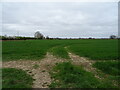
Crop field, Morton
View from Paddington Way.
Housing developments are encroaching on the farmland.
Image: © JThomas
Taken: 2 Apr 2021
0.11 miles
5
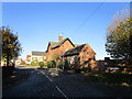
Former railway station, Morton
There is little evidence of the former railway from Bourne to Sleaford but the station house at Morton is largely intact though altered and extended.
Image: © Jonathan Thacker
Taken: 27 Oct 2019
0.15 miles
6
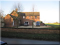
Morton Road railway station (site), Lincolnshire
Opened in 1872 by the Bourne and Sleaford Railway which was part of the Great Northern Railway empire, this station closed to passengers in 1930 and completely in 1964
View north towards Rippingale and Sleaford from near the site of the level crossing. The original station building and (possibly) northbound platform remnant are to the left. The vehicles and the house extension are across the site of the tracks and the southbound platform. As with other former stations on the line, it is now a private residence.
Image: © Nigel Thompson
Taken: 11 Nov 2012
0.15 miles
7
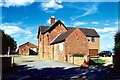
The old railway station at Morton, near Bourne, Lincolnshire
The railway station was built on the outskirts of Morton around 1872 when the line between Bourne and Sleaford was opened and it closed when freight traffic was terminated in 1964. The solid red brick property has since been turned into a private residence and the platform has been removed to make way for an extension with two garages although the engine shed and other outbuildings remain nearby.
Image: © Rex Needle
Taken: 19 Sep 1999
0.15 miles
9
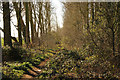
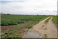
Course of old railway
Course of the former GNR / LNER railway on the old Bourne to Sleaford line http://www.pastscape.org.uk/hob.aspx?hob_id=1365418 just south of the former Morton Road Station. The line and station opened in 1872, closed to passenger trains in 1930 and closed altogether in 1964
Image: © Richard Croft
Taken: 10 Mar 2015
0.19 miles
10
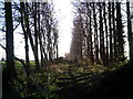
Old Railway line Morton, now used as a footpath
From the eastern end of Morton, this old railway track-bed is well used although not designated as a footpath.
Image: © Brian Green
Taken: 23 Nov 2006
0.21 miles