
IMAGES TAKEN NEAR TO
Poppy Place, BOURNE, PE10 0GL
Introduction
This page details the photographs taken nearby to Poppy Place, PE10 0GL by members of the Geograph project.
The Geograph project started in 2005 with the aim of publishing, organising and preserving representative images for every square kilometre of Great Britain, Ireland and the Isle of Man.

There are currently over 7.5m images from over14,400 individuals and you can help contribute to the project by visiting https://www.geograph.org.uk
Image Map
Images are licensed for reuse under creativecommons.org/licenses/by-sa/2.0
Notes
- Clicking on the map will re-center to the selected point.
- The higher the marker number, the further away the image location is from the centre of the postcode.
Image Listing (105 Images Found)
Images are licensed for reuse under creativecommons.org/licenses/by-sa/2.0
Image
Details
Distance
1

Elsea Park
Part of the once-controversial Elsea Park estate, built by Larkfleet homes.
Image: © Bob Harvey
Taken: 16 Aug 2014
0.07 miles
2

South Road in Bourne
At the junction with Eagle Road.
Image: © Mat Fascione
Taken: 12 Apr 2014
0.09 miles
3

House and Office
More and more people in Bourne work from home, but few put business signage on their homes.
Image: © Bob Harvey
Taken: 16 Aug 2014
0.09 miles
4

Quayside East, Bourne
This new development is on the southern edge of Bourne, just inside the Ring Road. This view is from Tilia Way.
Image: © Marathon
Taken: 3 May 2013
0.11 miles
5
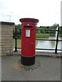
Pillar box
EIIR cipher on the pillar box on Quayside
Image: © Bob Harvey
Taken: 31 May 2017
0.11 miles
6
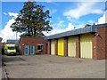
Ambulance station at Bourne, Lincolnshire
The present ambulance station was opened on a site at the corner of the Bourne Hospital complex in South Road in 1980 following a disastrous fire which wrecked the previous headquarters in Queen’s Road. The hospital has now closed and the buildings demolished and replaced by a housing estate but the ambulance station remains although financial restraints within the East Midlands Ambulance Service make its future uncertain.
Image: © Rex Needle
Taken: 19 Sep 2011
0.11 miles
7
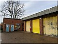
Bourne Ambulance Station
There used to be an ambulance garage at the fire station, but it was destroyed in a terrible fatal fire.
The replacement was built here, which at the time was in the grounds of the isolation hospital. That facility was torn away from us by NHS management, and in recent years the merger of the Lincolnshire and Nottinghamshire ambulance trusts nearly cost us the ambulance station too. But we need it, and much agitation saved the facility.
The ambulance station is now tucked away in a housing estate built where the hospital once stood.
Image: © Bob Harvey
Taken: 22 Dec 2020
0.11 miles
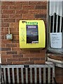
9

Quayside
A spurious name. There was never a quay here (although the location of the docks for the Roman Bourne-Morton canal is unknown). The water here is part of a mandatory flood control system disguised as a decorative pond. That said, with the lime trees and all, it looks nicer than I ever expected.
Image: © Bob Harvey
Taken: 16 Aug 2014
0.12 miles
10

Fountain in the catchment pool
This is not an original feature, or a landscape enhancement thoughtfully provided by the builder. It is a runoff capture basin, required because this estate is on land known to be at risk of flooding. This is intended to moderate the milder levels of inundation.
The fountain, too, is to reduce maintenance costs associated with the development of blanket weed
Image: © Bob Harvey
Taken: 31 May 2017
0.12 miles