
IMAGES TAKEN NEAR TO
Bluebell Way, BOURNE, PE10 0GG
Introduction
This page details the photographs taken nearby to Bluebell Way, PE10 0GG by members of the Geograph project.
The Geograph project started in 2005 with the aim of publishing, organising and preserving representative images for every square kilometre of Great Britain, Ireland and the Isle of Man.

There are currently over 7.5m images from over14,400 individuals and you can help contribute to the project by visiting https://www.geograph.org.uk
Image Map
Images are licensed for reuse under creativecommons.org/licenses/by-sa/2.0
Notes
- Clicking on the map will re-center to the selected point.
- The higher the marker number, the further away the image location is from the centre of the postcode.
Image Listing (101 Images Found)
Images are licensed for reuse under creativecommons.org/licenses/by-sa/2.0
Image
Details
Distance
2
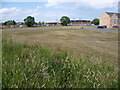
Supermarket off South Road, Bourne
Apart from the supermarket, the rest of the development in this area off South Road is so new that at the moment it does not appear on the Ordnance Survey or on Google Maps. Doubtless other buildings will follow.
Image: © Marathon
Taken: 2 Jul 2011
0.07 miles
3
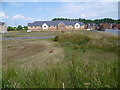
New development in Bourne
This development off South Road is so new that at the moment it does not appear on the Ordnance Survey or on Google Maps. The building in the centre is a care home whilst new housing is to the left and right. Doubtless other buildings will follow.
Image: © Marathon
Taken: 2 Jul 2011
0.08 miles
5

South Road in Bourne
At the junction with Eagle Road.
Image: © Mat Fascione
Taken: 12 Apr 2014
0.08 miles

8
Tesco carpark
I have no idea why the council think they can allow the town to double in size again. There are already twice as many homes as when they gave permission for this, and some of those were built on what had been the similarly sized Co-op "Rainbow" superstore. It really worries me where all these proposed folk are supposed to shop, work, or go to school.
Image: © Bob Harvey
Taken: 14 Jan 2023
0.09 miles
9

Lorry called "Streamline"
The Tractor carried only the default manufacturer branding "Streamline", and the fabric sided trailer no legends of any description.
It's a Scania R450 Streamline, registration KEH WT50, left hand drive. The space on the registration plate for a national identifier is unused.
Image: © Bob Harvey
Taken: 5 Aug 2018
0.10 miles
