
IMAGES TAKEN NEAR TO
Setts Green, BOURNE, PE10 0FZ
Introduction
This page details the photographs taken nearby to Setts Green, PE10 0FZ by members of the Geograph project.
The Geograph project started in 2005 with the aim of publishing, organising and preserving representative images for every square kilometre of Great Britain, Ireland and the Isle of Man.

There are currently over 7.5m images from over14,400 individuals and you can help contribute to the project by visiting https://www.geograph.org.uk
Image Map
Images are licensed for reuse under creativecommons.org/licenses/by-sa/2.0
Notes
- Clicking on the map will re-center to the selected point.
- The higher the marker number, the further away the image location is from the centre of the postcode.
Image Listing (11 Images Found)
Images are licensed for reuse under creativecommons.org/licenses/by-sa/2.0
Image
Details
Distance
1
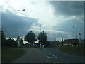
A151 Raymond Mays Way at The Gables roundabout
Image: © Colin Pyle
Taken: 10 Aug 2016
0.09 miles
2
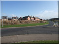
Elsea Park, Bourne
Part of a major new housing development on the south side of Bourne http://homepages.which.net/~rex/bourne/elseapark.htm
Image: © Tim Heaton
Taken: 8 Nov 2009
0.09 miles
3
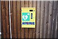
Defibrillator at the Community Centre
On the outer wall of Image
Image: © Bob Harvey
Taken: 17 Feb 2019
0.12 miles
4
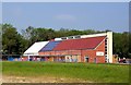
Elsea Park community centre at Bourne, Lincolnshire
The developers of the Elsea Park estate at Bourne financed and built this new £750,000 community centre which opened in 2012 and is now the centre of social life for many people in the town as well as inhabitants of the estate where almost half of the planned 2,000 homes have already been built and occupied.
Image: © Rex Needle
Taken: 24 May 2012
0.13 miles
5
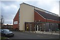
The Community Centre, Elsea Park
Part of the planning conditions for the construction of the Elsea Park Estate was the provision of a community centre. This is it.
Image: © Bob Harvey
Taken: 17 Feb 2019
0.13 miles
6
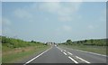
A151 Bourne Bypass
The Bourne bypass section of the A151 approaching Elsea Park, a modern housing development in the south of Bourne, named after Elsea Wood, which is visible on the right of this photograph.
Image: © Ajay Tegala
Taken: 28 Apr 2011
0.14 miles
8
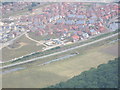
Elsea Park
An aerial photograph of Elsea Park taken in August 2005
Image: © Roger Callow
Taken: 9 Aug 2005
0.21 miles

10
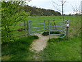
Kissing gate and path to Math Wood
At the Elsea Meadows Nature Reserve.
Image: © Mat Fascione
Taken: 12 Apr 2014
0.24 miles