
IMAGES TAKEN NEAR TO
Wakes Close, BOURNE, PE10 0BU
Introduction
This page details the photographs taken nearby to Wakes Close, PE10 0BU by members of the Geograph project.
The Geograph project started in 2005 with the aim of publishing, organising and preserving representative images for every square kilometre of Great Britain, Ireland and the Isle of Man.

There are currently over 7.5m images from over14,400 individuals and you can help contribute to the project by visiting https://www.geograph.org.uk
Image Map
Images are licensed for reuse under creativecommons.org/licenses/by-sa/2.0
Notes
- Clicking on the map will re-center to the selected point.
- The higher the marker number, the further away the image location is from the centre of the postcode.
Image Listing (130 Images Found)
Images are licensed for reuse under creativecommons.org/licenses/by-sa/2.0
Image
Details
Distance
1

Historic buildings
Georgian buildings in Eastgate.
Image: © Bob Harvey
Taken: 23 Nov 2012
0.04 miles
2

The old tannery in Eastgate, Bourne, Lincolnshire
The tannery trade which brought prosperity to Bourne in past centuries was centred on the Eastgate area which gave access to a constant water supply from the Bourne Eau which runs through the area. Several businesses thrived there and the owners built fine properties for their work and homes although these here have since been converted into apartments.
Image: © Rex Needle
Taken: 9 Dec 2013
0.04 miles
3

The Anchor Inn
I was hoping to take a closeup of the old Admiralty-style anchor hung on the wall of this inn. It's not there. If you look closely it is on the patio, visible leaning on the little wall there.
Image: © Bob Harvey
Taken: 5 Oct 2015
0.05 miles
4

The Anchor Inn
Eastgate view of the Anchor Inn, a grade II listed, 18th century public house by Bourne Eau
Image: © Richard Croft
Taken: 9 Aug 2013
0.06 miles
5

Aircraft hangars get new lease of life at Bourne, Lincolnshire
Disused aeroplane hangars which were dismantled and moved to Bourne by road from an airfield in Norfolk after the First World War were re-erected for use as a fertiliser factory in Cherryholt Road and are still in use today as a trading estate.
Image: © Rex Needle
Taken: 21 Jun 2001
0.06 miles

7

Tiny house
This tiny house was built in the 21st century, and is dwarfed by the victorian workman's cottages beyond, which would normally be considered small.
Image: © Bob Harvey
Taken: 23 Nov 2012
0.06 miles
8

The Anchor, Eastgate
The Bourne Eau was navigable, and improved after an act of 1781 allowed for the building of locks. Navigation extended past the old warehouses in Cherry Holt Road up to about this point, where the car Dyke and the Eau meet in a wide basin. There were warehouses all along the southern edge of Eastgate (one, now a house, can be seen beyond the pub).
The pub dates back to the navigable era: the name gives it away. The ceilings inside are too low for a Victorian building, it is at least 18th century. The building was thatched until the 20th century.
Navigation on the Eau ended in the 1860s when the lock-like junction with the Glen at Tongue End.
There is a good description of navigation on the Eau here:
http://www.eawa.co.uk/bourne.html
Image: © Bob Harvey
Taken: 23 Nov 2012
0.06 miles
9

The Anchor Inn at Bourne, Lincolnshire
The ancient Anchor Inn stands near what used to be the Eastgate quayside in past centuries when the Bourne Eau was navigable and boatmen arriving aboard cargo ships and barges provided a regular clientele for the hostelry.
Image: © Rex Needle
Taken: 18 Aug 2008
0.06 miles
10
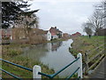
Anchor Inn
The Anchor, seen from across the water. A real admiralty pattern anchor hangs on the wall over the river.
See also Image and Image
In the distance are the 18th century warehouses in Image
Image: © Bob Harvey
Taken: 12 Dec 2012
0.06 miles