IMAGES TAKEN NEAR TO
ERSKINE, PA8 6EY
Introduction
This page details the photographs taken nearby to PA8 6EY by members of the Geograph project.
The Geograph project started in 2005 with the aim of publishing, organising and preserving representative images for every square kilometre of Great Britain, Ireland and the Isle of Man.

There are currently over 7.5m images from over14,400 individuals and you can help contribute to the project by visiting https://www.geograph.org.uk
Image Map
Images are licensed for reuse under creativecommons.org/licenses/by-sa/2.0
Notes
- Clicking on the map will re-center to the selected point.
- The higher the marker number, the further away the image location is from the centre of the postcode.
Image Listing (33 Images Found)
Images are licensed for reuse under creativecommons.org/licenses/by-sa/2.0
Image
Details
Distance
1
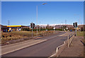
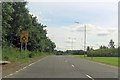
A726, Rashielee, Erskine
Crossing near the petrol station. Kilpatrick Hills in the distance.
Image: © wfmillar
Taken: 1 Mar 2010
0.03 miles
2
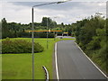
Looking south on A726
To the Shell petrol station at Centreholm Roundabout.
Image: © Stephen Sweeney
Taken: 21 Jul 2007
0.05 miles
3
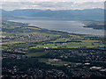
Erskine and the Firth of Clyde from the air
Park Mains High School is front and Centre, Morrisons supermarket is in the lower right corner. Greenock and Gourock can be seen in the left distance.
Image: © Thomas Nugent
Taken: 22 Jun 2015
0.07 miles
7
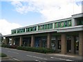
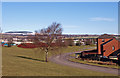
Bridgewater Centre
It's Erskine, there is a bridge, it goes over water - wonderfully imaginative naming typical of a newly planted community. Usual dull array of shops - but a useful supermarket to get some food for the hill.
Image: © Richard Webb
Taken: 26 Jul 2005
0.15 miles
8
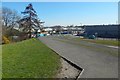
View to shopping centre
The view is from the foot of Image That picture was taken from the same area, although the view is in the opposite direction.
Image: © Lairich Rig
Taken: 27 Mar 2017
0.15 miles
9
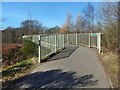
Footbridge over the A726
The steps shown in Image lead here. The small sign, like others nearby, says "Craigends Hill" ("Craigend Hill" on the map).
Image: © Lairich Rig
Taken: 27 Mar 2017
0.16 miles
10
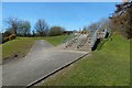
Steps leading to a footbridge
This feature can be seen ahead, from a distance, in Image The steps lead to a Image; the footbridge is marked on the map.
For a view in the opposite direction from the foot of the steps, see Image
Image: © Lairich Rig
Taken: 27 Mar 2017
0.16 miles