IMAGES TAKEN NEAR TO
Achnaha View, OBAN, PA80 5AB
Introduction
This page details the photographs taken nearby to Achnaha View, PA80 5AB by members of the Geograph project.
The Geograph project started in 2005 with the aim of publishing, organising and preserving representative images for every square kilometre of Great Britain, Ireland and the Isle of Man.

There are currently over 7.5m images from over14,400 individuals and you can help contribute to the project by visiting https://www.geograph.org.uk
Image Map
Images are licensed for reuse under creativecommons.org/licenses/by-sa/2.0
Notes
- Clicking on the map will re-center to the selected point.
- The higher the marker number, the further away the image location is from the centre of the postcode.
Image Listing (11 Images Found)
Images are licensed for reuse under creativecommons.org/licenses/by-sa/2.0
Image
Details
Distance
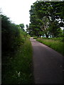
1
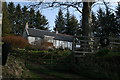
Achnaha, Morvern
A vast forest beyond.
Image: © Richard Webb
Taken: 12 Jul 2021
0.04 miles

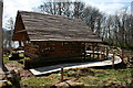
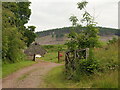
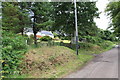
4

Achnaha Community Woodland Car Park
The sign also has a Gaelic description : Coille Choimhearsnachd Achnaha
Image: © Michael Jagger
Taken: 27 Jul 2010
0.08 miles
7

Dry stone wall
The stone in the wall is carved with the following inscription:
John McDonald
Achnaha
1884
Image: © Michael Jagger
Taken: 27 Jul 2010
0.16 miles