IMAGES TAKEN NEAR TO
Barrapoll, ISLE OF TIREE, PA77 6XJ
Introduction
This page details the photographs taken nearby to PA77 6XJ by members of the Geograph project.
The Geograph project started in 2005 with the aim of publishing, organising and preserving representative images for every square kilometre of Great Britain, Ireland and the Isle of Man.

There are currently over 7.5m images from over14,400 individuals and you can help contribute to the project by visiting https://www.geograph.org.uk
Image Map
Images are licensed for reuse under creativecommons.org/licenses/by-sa/2.0
Notes
- Clicking on the map will re-center to the selected point.
- The higher the marker number, the further away the image location is from the centre of the postcode.
Image Listing (15 Images Found)
Images are licensed for reuse under creativecommons.org/licenses/by-sa/2.0
Image
Details
Distance
2
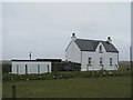
B8065, Barrapol
Heading for the church and crossroads at Heylipol.
Image: © Richard Webb
Taken: 4 Aug 2019
0.06 miles
3
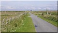
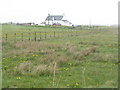
Farm entrance road
This farm access is from the B8065 near to Barrapol, Isle of Tiree.
Image: © Peter Mackenzie
Taken: 22 Jun 2017
0.08 miles
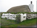
4
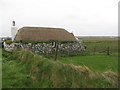
Thatched house at Barrapol
A well restored black house.
Image: © M J Richardson
Taken: 21 May 2015
0.10 miles
5
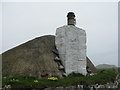
Chimney and thatch at Barrapol
A black house, with primroses and grass on the top of the wall.
Image: © M J Richardson
Taken: 21 May 2015
0.10 miles
6
Black house at Barrapol
Nicely restored, but with non-period garden seats.
Image: © M J Richardson
Taken: 21 May 2015
0.10 miles
7
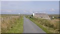
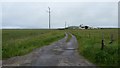
Thatched house, Barrapol
The B8065 heads to vanishing point across the flat interior of Tiree.
Image: © Richard Webb
Taken: 4 Aug 2019
0.10 miles
8
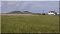
View towards Beinn Hough from Barrapol
Hay meadow, Tiree.
Image: © Richard Webb
Taken: 4 Aug 2019
0.11 miles
10
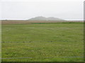
Machair at Barrapol
Disappointingly dull, due to a cold, late spring. The hills beyond are Cnoc an Fhithich[with mast] and Beinn Hough, about 3km to the north..
Image: © M J Richardson
Taken: 21 May 2015
0.13 miles