IMAGES TAKEN NEAR TO
Kilmacolm Road, JOHNSTONE, PA6 7HY
Introduction
This page details the photographs taken nearby to Kilmacolm Road, PA6 7HY by members of the Geograph project.
The Geograph project started in 2005 with the aim of publishing, organising and preserving representative images for every square kilometre of Great Britain, Ireland and the Isle of Man.

There are currently over 7.5m images from over14,400 individuals and you can help contribute to the project by visiting https://www.geograph.org.uk
Image Map
Images are licensed for reuse under creativecommons.org/licenses/by-sa/2.0
Notes
- Clicking on the map will re-center to the selected point.
- The higher the marker number, the further away the image location is from the centre of the postcode.
Image Listing (21 Images Found)
Images are licensed for reuse under creativecommons.org/licenses/by-sa/2.0
Image
Details
Distance
2
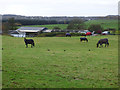
Horses near Waterlea Farm
Viewed from Kilallan Road.
Image: © Thomas Nugent
Taken: 8 Nov 2018
0.05 miles
3
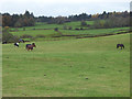
Horses near Waterlea Farm
Viewed from Kilallan Road.
Image: © Thomas Nugent
Taken: 8 Nov 2018
0.09 miles
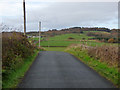
4
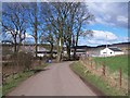
Kilallan Road
Barfillan Farm can be seen in the distance.
Image: © Thomas Nugent
Taken: 8 Nov 2018
0.15 miles
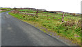
5

Field gate
On Kilallan Road, near Waterlea Farm.
Image: © Thomas Nugent
Taken: 8 Nov 2018
0.15 miles
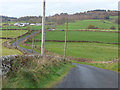
6
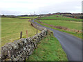
Kilallan Road
Winding its way uphill towards Kilmacolm.
Image: © Thomas Nugent
Taken: 8 Nov 2018
0.16 miles
7
Kilallan Road
Heading up the hill towards Barfillan Farm.
Image: © Thomas Nugent
Taken: 8 Nov 2018
0.16 miles
8
Kilallan Road
Between Waterlea Farm and Barfillan Farm.
Image: © Thomas Nugent
Taken: 8 Nov 2018
0.16 miles
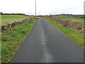
9
Kilallan Road
Looking towards Kilmacolm, near Waterlea Farm.
Image: © Thomas Nugent
Taken: 8 Nov 2018
0.16 miles
10
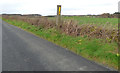
Kilallan Road
A roadside marker near Barfillan Farm.
Image: © Thomas Nugent
Taken: 8 Nov 2018
0.16 miles