IMAGES TAKEN NEAR TO
Craigends Road, JOHNSTONE, PA6 7BD
Introduction
This page details the photographs taken nearby to Craigends Road, PA6 7BD by members of the Geograph project.
The Geograph project started in 2005 with the aim of publishing, organising and preserving representative images for every square kilometre of Great Britain, Ireland and the Isle of Man.

There are currently over 7.5m images from over14,400 individuals and you can help contribute to the project by visiting https://www.geograph.org.uk
Image Map
Images are licensed for reuse under creativecommons.org/licenses/by-sa/2.0
Notes
- Clicking on the map will re-center to the selected point.
- The higher the marker number, the further away the image location is from the centre of the postcode.
Image Listing (40 Images Found)
Images are licensed for reuse under creativecommons.org/licenses/by-sa/2.0
Image
Details
Distance
1
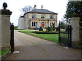
Ardgryfe House
On Craigends Road, Category B Listed http://portal.historicenvironment.scot/designation/LB12691 .
Image: © Thomas Nugent
Taken: 8 Nov 2018
0.04 miles
2
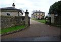
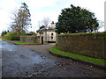
Ardgryfe House and Lodge
The lodge is Category C Listed http://portal.historicenvironment.scot/designation/LB12691 , the house is Category B Listed http://portal.historicenvironment.scot/designation/LB12691 .
Image: © Thomas Nugent
Taken: 8 Nov 2018
0.04 miles
4
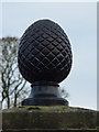
Ardgryfe House gatepost finial
Appears to be made of cast iron. See it in situ Image
Image: © Thomas Nugent
Taken: 8 Nov 2018
0.04 miles
5
Ardgryfe House Lodge
At the entrance to Ardgryfe House on Craigends Road. Category C Listed http://portal.historicenvironment.scot/designation/LB12691 .
Image: © Thomas Nugent
Taken: 8 Nov 2018
0.04 miles
6
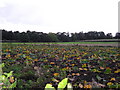
Rhubarb Patch
Rhubarb plants are perennial and are grown for their edible leaf stalks, although classed as a vegetable rhubarb is more usually eaten in desserts.
In this picture the plants are now dying back for the winter.
Image: © Chris Court
Taken: 29 Sep 2005
0.06 miles
7
Ardgryfe House
Looking north from Craigends Road.
Image: © Thomas Nugent
Taken: 8 Nov 2018
0.08 miles
8
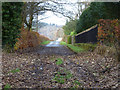
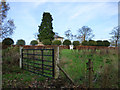
Craigends Road
A dead-end lane off the B790 Houston Road, serving farms and cottages.
Image: © Thomas Nugent
Taken: 29 Aug 2018
0.09 miles
9
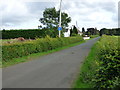
Craigends Road
Looking south at Ardgryfe towards the ford at the River Gryffe.
Image: © Thomas Nugent
Taken: 8 Nov 2018
0.10 miles
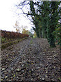
10
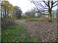
Woodland at Ardgryfe
The woodland separates the Houston village housing estates and Ardgryfe House.
Image: © Thomas Nugent
Taken: 8 Nov 2018
0.11 miles