IMAGES TAKEN NEAR TO
Bunessan, ISLE OF MULL, PA67 6DU

Introduction

This page details the photographs taken nearby to PA67 6DU by members of the Geograph project.

The Geograph project started in 2005 with the aim of publishing, organising and preserving representative images for every square kilometre of Great Britain, Ireland and the Isle of Man.

There are currently over 7.5m images from over14,400 individuals and you can help contribute to the project by visiting https://www.geograph.org.uk

Image Map


Images are licensed for reuse under creativecommons.org/licenses/by-sa/2.0
Notes
  • Clicking on the map will re-center to the selected point.
  • The higher the marker number, the further away the image location is from the centre of the postcode.

Image Listing (6 Images Found)

Images are licensed for reuse under creativecommons.org/licenses/by-sa/2.0
Image
Details
Distance
1
Approaching Bendoran Cottage from the north
Image: © John McLuckie Taken: 19 Sep 2007
0.04 miles
2
Gated field entrance
Image: © Steven Brown Taken: 12 Oct 2023
0.17 miles
3
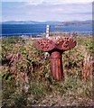
Old Milepost by the A849, above Loch na Lathaich
Blaydon milepost by the A849, in parish of Kilfinichen & Kilvickeon (Mull District), near Bendoran Cottage, overlooking Loch na Lathaich. Inscription reads:- : SALEN / 34 / MILES : : 1897 : : IONA FERRY / 4 / MILES : Maker: : SMITH PATTERSON / BLAYDON : Surveyed Milestone Society National ID: AB_MLSAIF34.
Image: © Milestone Society Taken: Unknown
0.18 miles
4
Peering over the fence at a vegetative choked landscape
Taken from the verge of the A road.
Image: © C Michael Hogan Taken: 5 Jul 2010
0.22 miles
5
Loch na Lathaich View
Looking across Loch na Lathaich to the distant mountains of Creach Bheinn and Bein na Sreine.
Image: © Mary and Angus Hogg Taken: 29 Apr 2013
0.23 miles
6
The Landing Stage at Camas na Criatha
This remote spot is a useful mooring for Bunessan which is too shallow for visiting yachts.
Image: © Frank Smith Taken: 15 May 2006
0.24 miles