IMAGES TAKEN NEAR TO
Martlet Drive, JOHNSTONE, PA5 0SJ
Introduction
This page details the photographs taken nearby to Martlet Drive, PA5 0SJ by members of the Geograph project.
The Geograph project started in 2005 with the aim of publishing, organising and preserving representative images for every square kilometre of Great Britain, Ireland and the Isle of Man.

There are currently over 7.5m images from over14,400 individuals and you can help contribute to the project by visiting https://www.geograph.org.uk
Image Map
Images are licensed for reuse under creativecommons.org/licenses/by-sa/2.0
Notes
- Clicking on the map will re-center to the selected point.
- The higher the marker number, the further away the image location is from the centre of the postcode.
Image Listing (10 Images Found)
Images are licensed for reuse under creativecommons.org/licenses/by-sa/2.0
Image
Details
Distance
1
The Osprey
Pub off Hallhill Road, Spateston. The steps lead to a pedestrian tunnel under Hallhill Road.
Image: © Richard Webb
Taken: 2 Jan 2017
0.08 miles

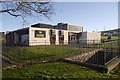
5
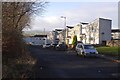
Johnstone High School (site)
Image has moved leaving an obvious former school site behind broken railings.
Image: © Richard Webb
Taken: 25 Apr 2014
0.19 miles
6
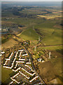
Spateston from the air
A suburb in south west Johnstone. Spateston Road is prominent.
Image: © Thomas Nugent
Taken: 16 Mar 2016
0.19 miles
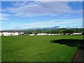
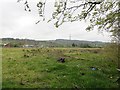
7
Green space off Hallhill Road
Johnstone, Renfrewshire. View from Beith Road.
Image: © Richard Webb
Taken: 25 Apr 2014
0.22 miles
8
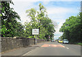
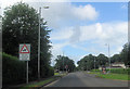
Running into Johnstone on B787 Beith road
Image: © John Firth
Taken: 11 May 2011
0.23 miles
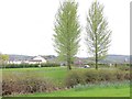
9
Spateston Road
Edge of the urban area southwest of Johnstone.
Image: © Richard Webb
Taken: 2 Jan 2017
0.23 miles