IMAGES TAKEN NEAR TO
Luckinsford Avenue, RENFREW, PA4 9RA
Introduction
This page details the photographs taken nearby to Luckinsford Avenue, PA4 9RA by members of the Geograph project.
The Geograph project started in 2005 with the aim of publishing, organising and preserving representative images for every square kilometre of Great Britain, Ireland and the Isle of Man.

There are currently over 7.5m images from over14,400 individuals and you can help contribute to the project by visiting https://www.geograph.org.uk
Image Map
Images are licensed for reuse under creativecommons.org/licenses/by-sa/2.0
Notes
- Clicking on the map will re-center to the selected point.
- The higher the marker number, the further away the image location is from the centre of the postcode.
Image Listing (42 Images Found)
Images are licensed for reuse under creativecommons.org/licenses/by-sa/2.0
Image
Details
Distance
1
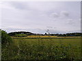
Looking to Inchinnan from Greenock Road A8
Across the field to the north of the road.
Image: © Stephen Sweeney
Taken: 21 Jul 2007
0.05 miles
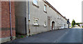
2
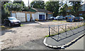
Yard on Old Greenock Road
Looks like it was possibly a petrol station in the past.
Image: © Thomas Nugent
Taken: 25 Aug 2018
0.08 miles
3
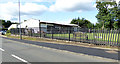
Inchinnan playing field
Off Old Greenock Road.
Image: © Thomas Nugent
Taken: 25 Aug 2018
0.08 miles
5
Inchinnan Community Centre
At Old Greenock Road, in the centre of the village.
Image: © Thomas Nugent
Taken: 25 Aug 2018
0.10 miles
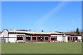
6
Inchinnan Bowling Club
At Old Greenock Road.
Image: © Thomas Nugent
Taken: 25 Aug 2018
0.10 miles
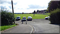
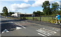
7
Old Greenock Road
At Inchinnan Primary School.
Image: © Thomas Nugent
Taken: 25 Aug 2018
0.11 miles
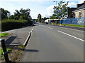
8
Old Greenock Road
Sheltered housing flats on the west side of the road.
Image: © Thomas Nugent
Taken: 25 Aug 2018
0.11 miles
9
Inchinnan Community Assoc Bowling Club
Image: © Leslie Barrie
Taken: 24 Mar 2014
0.11 miles
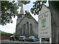
10

Former Park Parish Church weather vane
On the church tower on Luckinsford Road. Category B Listed
http://portal.historicenvironment.scot/designation/LB12731 .
Image: © Thomas Nugent
Taken: 25 Aug 2018
0.11 miles