IMAGES TAKEN NEAR TO
Gibson Road, RENFREW, PA4 0RH
Introduction
This page details the photographs taken nearby to Gibson Road, PA4 0RH by members of the Geograph project.
The Geograph project started in 2005 with the aim of publishing, organising and preserving representative images for every square kilometre of Great Britain, Ireland and the Isle of Man.

There are currently over 7.5m images from over14,400 individuals and you can help contribute to the project by visiting https://www.geograph.org.uk
Image Map
Images are licensed for reuse under creativecommons.org/licenses/by-sa/2.0
Notes
- Clicking on the map will re-center to the selected point.
- The higher the marker number, the further away the image location is from the centre of the postcode.
Image Listing (33 Images Found)
Images are licensed for reuse under creativecommons.org/licenses/by-sa/2.0
Image
Details
Distance
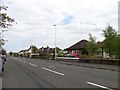
1
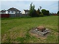
Grass beside a path to Cockels Loan
The houses are on Gleniffer Road. The view is from beside the path shown in Image / Image / Image
The 1939 revision of the OS map shows a building 25 metres ESE of the location of the blocked hole just ahead (which was presumably associated with it), with a couple of smaller buildings (too small to be houses) not far to the north of that building. They are not labelled, but their general layout suggests that they were associated with a water tank or some other kind of waterworks.
Image: © Lairich Rig
Taken: 19 May 2018
0.10 miles
2
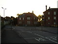
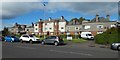
Traffic lights
At junction between Cockels Loan and Paisley Road.
Image: © Stephen Sweeney
Taken: 7 Aug 2007
0.10 miles
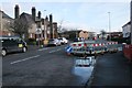
4
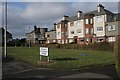
29-33 Cockels Loan
Distinctive buildings.
Image: © Richard Sutcliffe
Taken: 16 Feb 2018
0.12 miles
6
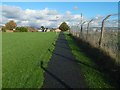
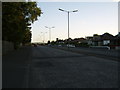
Path to Cockels Loan
The fence on the right is marked on the 1:25000 map, and encloses the grounds of a large fitness centre. The path is in Image, at the south-western extremity of Renfrew. Followed in this direction, it leads from Arkleston Road to Cockels Loan (Image).
The picture of Image was taken from just a short distance beyond the point from which the present picture was taken.
For a view in the opposite direction along the same path, see Image
Image: © Lairich Rig
Taken: 3 Nov 2014
0.12 miles
8
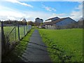
Path to Arkleston Road
The location is the south-western extremity of Renfrew. Followed in this direction, the path, which is in Image, leads from Cockels Loan (Image) to Arkleston Road.
In the background, left of centre, some demolition work can be seen taking place: Image Two other high flats appear more centrally in the background: Image in front of Image
Much closer, to the right of the path, is Image The fence on the left encloses the grounds of a large fitness centre, which is marked on the map, but not visible in the picture.
For a view in the opposite direction along the same path, see Image That path also appears in the picture of Image
Image: © Lairich Rig
Taken: 3 Nov 2014
0.12 miles
9
29-33 Cockels Loan
Two earlier and closer views: Image / Image The motifs of balconies and round tower-like features are repeated throughout the area.
Image: © Lairich Rig
Taken: 22 Sep 2018
0.13 miles
10
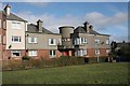
29-33 Cockels Loan
Distinctive buildings.
Image: © Richard Sutcliffe
Taken: 16 Feb 2018
0.13 miles