IMAGES TAKEN NEAR TO
Kentallen, APPIN, PA38 4BU
Introduction
This page details the photographs taken nearby to PA38 4BU by members of the Geograph project.
The Geograph project started in 2005 with the aim of publishing, organising and preserving representative images for every square kilometre of Great Britain, Ireland and the Isle of Man.

There are currently over 7.5m images from over14,400 individuals and you can help contribute to the project by visiting https://www.geograph.org.uk
Image Map
Images are licensed for reuse under creativecommons.org/licenses/by-sa/2.0
Notes
- Clicking on the map will re-center to the selected point.
- The higher the marker number, the further away the image location is from the centre of the postcode.
Image Listing (16 Images Found)
Images are licensed for reuse under creativecommons.org/licenses/by-sa/2.0
Image
Details
Distance
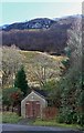
2
House at a sharp corner of the A828 at Kentallen
Image: © Steven Brown
Taken: 4 Nov 2010
0.01 miles
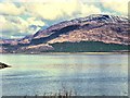
6
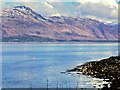
Kentallan Bay
View looking up Kentallan Bay.
Image: © Peter McDermott
Taken: 30 May 2016
0.09 miles
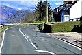
7
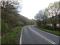
A828
One of the bits of National Cycle Network route 78 which is still on the main road.
Image: © Richard Webb
Taken: 17 Apr 2014
0.10 miles
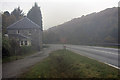
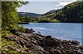
8
Kentallen
A828 roadside looking over Kentallen Bay.
Image: © Johnny Durnan
Taken: 7 Oct 2007
0.11 miles
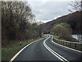
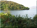
10
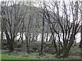
Ballachulish Branch trackbed
A section of the old railway which has not been used by the National Cycle Network.
Image: © Richard Webb
Taken: 17 Apr 2014
0.12 miles