IMAGES TAKEN NEAR TO
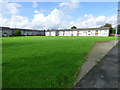
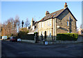
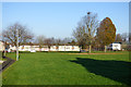
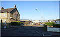
Wendur Way, PAISLEY, PA3 2QP
Introduction
This page details the photographs taken nearby to Wendur Way, PA3 2QP by members of the Geograph project.
The Geograph project started in 2005 with the aim of publishing, organising and preserving representative images for every square kilometre of Great Britain, Ireland and the Isle of Man.

There are currently over 7.5m images from over14,400 individuals and you can help contribute to the project by visiting https://www.geograph.org.uk
Image Map
Images are licensed for reuse under creativecommons.org/licenses/by-sa/2.0
Notes
- Clicking on the map will re-center to the selected point.
- The higher the marker number, the further away the image location is from the centre of the postcode.
Image Listing (233 Images Found)
Images are licensed for reuse under creativecommons.org/licenses/by-sa/2.0
Image
Details
Distance
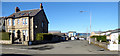
1
Albany Way
Albany Way is on the right, Birkenshaw Way is on the left.
Image: © Thomas Nugent
Taken: 25 Sep 2017
0.04 miles
2
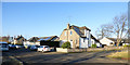
Marchfield Avenue
Between Shortroods and Glasgow Airport.
Image: © Thomas Nugent
Taken: 4 Dec 2016
0.06 miles
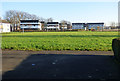
3
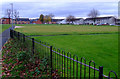
Parkland at Shortroods Road
Looking towards Mosslands Road.
Image: © Thomas Nugent
Taken: 4 Dec 2016
0.06 miles
4
Marchfield Avenue
Between Shortroods and Glasgow Airport.
Image: © Thomas Nugent
Taken: 4 Dec 2016
0.07 miles
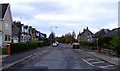
5
Marchfield Avenue
A private road apparently.
Image: © Thomas Nugent
Taken: 19 Mar 2018
0.07 miles
6
Office Pavilions
At Inchinnan Road, viewed from Mosslands Road.
Image: © Thomas Nugent
Taken: 4 Dec 2016
0.07 miles
7
Construction site on Marchfield Avenue
New houses under construction. Viewed from the footpath from Mosslands Road.
Image: © Thomas Nugent
Taken: 14 May 2018
0.08 miles
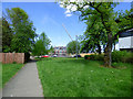
9
Mosslands Road
Viewed from the footpath to Marchfield Avenue.
Image: © Thomas Nugent
Taken: 22 Nov 2010
0.08 miles
10
Marchfield Avenue
Between Shortroods and Glasgow Airport.
Image: © Thomas Nugent
Taken: 4 Dec 2016
0.08 miles