IMAGES TAKEN NEAR TO
Furnace, INVERARAY, PA32 8XU
Introduction
This page details the photographs taken nearby to PA32 8XU by members of the Geograph project.
The Geograph project started in 2005 with the aim of publishing, organising and preserving representative images for every square kilometre of Great Britain, Ireland and the Isle of Man.

There are currently over 7.5m images from over14,400 individuals and you can help contribute to the project by visiting https://www.geograph.org.uk
Image Map
Images are licensed for reuse under creativecommons.org/licenses/by-sa/2.0
Notes
- Clicking on the map will re-center to the selected point.
- The higher the marker number, the further away the image location is from the centre of the postcode.
Image Listing (12 Images Found)
Images are licensed for reuse under creativecommons.org/licenses/by-sa/2.0
Image
Details
Distance
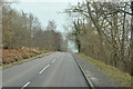
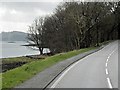
5
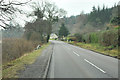
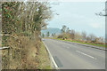
The A83 entering Furnace
The A83 entering Furnace beside Long Fyne.
Image: © Philip Halling
Taken: 27 Jun 2019
0.14 miles
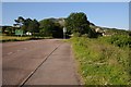
6
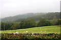
Sheep by Sandhole
Sheep grazing in a field between Sandhole and Furnace.
Image: © Andrew Wood
Taken: 4 Aug 2011
0.18 miles
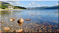
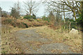
7
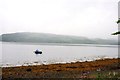
Loch Fyne Mooring
A small boat moored by the shore near Sandhole.
Image: © Andrew Wood
Taken: 4 Aug 2011
0.19 miles