IMAGES TAKEN NEAR TO
Carsegreen Avenue, PAISLEY, PA2 8SB
Introduction
This page details the photographs taken nearby to Carsegreen Avenue, PA2 8SB by members of the Geograph project.
The Geograph project started in 2005 with the aim of publishing, organising and preserving representative images for every square kilometre of Great Britain, Ireland and the Isle of Man.

There are currently over 7.5m images from over14,400 individuals and you can help contribute to the project by visiting https://www.geograph.org.uk
Image Map
Images are licensed for reuse under creativecommons.org/licenses/by-sa/2.0
Notes
- Clicking on the map will re-center to the selected point.
- The higher the marker number, the further away the image location is from the centre of the postcode.
Image Listing (30 Images Found)
Images are licensed for reuse under creativecommons.org/licenses/by-sa/2.0
Image
Details
Distance
2
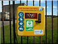
Defibrillator
On the railings outside Langcraigs Primary School.
Image: © Richard Sutcliffe
Taken: 14 Apr 2023
0.07 miles
3
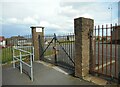
Entrance gates to school
The way in to Langcraigs Primary School. The gates are locked as it's the Easter holidays.
Image: © Richard Sutcliffe
Taken: 14 Apr 2023
0.07 miles
5
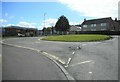
Bus turning circle
Beside Langcraigs Primary School.
Image: © Richard Sutcliffe
Taken: 14 Apr 2023
0.07 miles
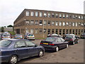
6
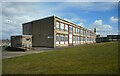
Langcraigs Primary School
One of many primary schools in Paisley.
Image: © Richard Sutcliffe
Taken: 14 Apr 2023
0.09 miles
7
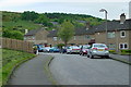
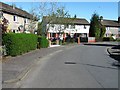
Paisley - Glenburn - Caplaw Road
Paisley - Glenburn - Caplaw Road
Delightful little street...
One of the better streets in Glenburn which is really the Nethercraigs area.
Image: © Vic Nelson
Taken: 1 May 2006
0.09 miles

9
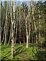
A path through the woods
The woods are located just to the north of an area that is known locally as Image (these woods appear in the background of that photograph). On the far side of the woods, a network of paths leads to Gleniffer Road and elsewhere.
Image: © Lairich Rig
Taken: 2 May 2012
0.16 miles
10
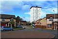
Braeview Avenue
Braeview Avenue on the outskirts of Paisley. One of the Glenburn High Flats blocks is shown in the background.
Image: © Mary and Angus Hogg
Taken: 4 May 2013
0.17 miles