IMAGES TAKEN NEAR TO
Fort Argyll Road, CAMPBELTOWN, PA28 6SN

Introduction

This page details the photographs taken nearby to Fort Argyll Road, PA28 6SN by members of the Geograph project.

The Geograph project started in 2005 with the aim of publishing, organising and preserving representative images for every square kilometre of Great Britain, Ireland and the Isle of Man.

There are currently over 7.5m images from over14,400 individuals and you can help contribute to the project by visiting https://www.geograph.org.uk

Image Map


Images are licensed for reuse under creativecommons.org/licenses/by-sa/2.0
Notes
  • Clicking on the map will re-center to the selected point.
  • The higher the marker number, the further away the image location is from the centre of the postcode.

Image Listing (16 Images Found)

Images are licensed for reuse under creativecommons.org/licenses/by-sa/2.0
Image
Details
Distance
1
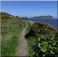
Footpath by Campbeltown Loch, Argyll
Looking towards Island Davaar. A distinct footpath runs between Trench Point and a picnic table near Black Rock. A less defined path can followed beyond to Macringan's Point.
Image: © Claire Pegrum Taken: 30 May 2021
0.05 miles
2
Entrance to Campbeltown Bay and Davaar Island from Trench Point
Image: © J M Briscoe Taken: 29 Jun 2005
0.06 miles
3
Campbeltown Bay
Image: © J M Briscoe Taken: 29 Jun 2005
0.07 miles
4
Campbeltown from Trench Point
Site of Campbeltown Shipyard
Image: © J M Briscoe Taken: 29 Jun 2005
0.07 miles
5
Campbeltown from Trench Point
Site of Campbeltown Shipyard
Image: © J M Briscoe Taken: 29 Jun 2005
0.07 miles
6
Campbeltown Shipyard
Image: © J M Briscoe Taken: 29 Jun 2005
0.07 miles
7
Trench Point and Fort Argyll
Out on the loch, before a bruising encounter with the swell towards Sanda.
Image: © Richard Webb Taken: 29 Apr 2012
0.09 miles
8
Campbeltown Loch and the Doirlinn
Viewed from the B842 above Campbeltown, this view takes in the sea entry into the port, through the red and green channel buoys, as well as the Doirlinn, the shingle bank that links the mainland with Davaar Island at low water. The red and white beacon marks the NW limit of the Doirlinn.
Image: © Bob Jones Taken: 4 May 2008
0.14 miles
9
The B842 at High Askomill
Looking back to Campbeltown. The cloud is sitting low on the hill tops.
Image: © Gordon Brown Taken: 23 Sep 2013
0.14 miles
10
Campbeltown View
Looking towards the north side of Campbeltown Loch, near Trench Point, from the summer 2013 Ardrossan ferry.
Image: © Mary and Angus Hogg Taken: 18 Aug 2013
0.15 miles