IMAGES TAKEN NEAR TO
Craw Road, PAISLEY, PA2 6AD
Introduction
This page details the photographs taken nearby to Craw Road, PA2 6AD by members of the Geograph project.
The Geograph project started in 2005 with the aim of publishing, organising and preserving representative images for every square kilometre of Great Britain, Ireland and the Isle of Man.

There are currently over 7.5m images from over14,400 individuals and you can help contribute to the project by visiting https://www.geograph.org.uk
Image Map
Images are licensed for reuse under creativecommons.org/licenses/by-sa/2.0
Notes
- Clicking on the map will re-center to the selected point.
- The higher the marker number, the further away the image location is from the centre of the postcode.
Image Listing (75 Images Found)
Images are licensed for reuse under creativecommons.org/licenses/by-sa/2.0
Image
Details
Distance
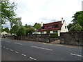
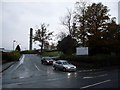
1
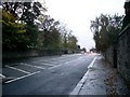
Craw Road, Paisley
Runs to the north of the Royal Alexandra Hospital.
Image: © Stephen Sweeney
Taken: 29 Oct 2009
0.02 miles
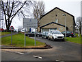
2
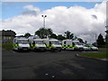
A quiet day at Paisley Ambulance Station
Image: © John Ferguson
Taken: 22 Jul 2009
0.03 miles
4
Telecommunications mast at Paisley's Royal Alexandra Hospital
Image: © Stephen Sweeney
Taken: 29 Oct 2009
0.05 miles
6
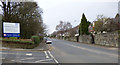
Craw Road
At the entrance to Royal Alexandra Infirmary.
Image: © Thomas Nugent
Taken: 29 Feb 2016
0.06 miles
7
Craw Road
At the entrance to Royal Alexandra Infirmary.
Image: © Thomas Nugent
Taken: 29 Feb 2016
0.06 miles
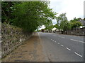
8
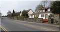
Craw Road
Looking west near Polsons Crescent.
Image: © Thomas Nugent
Taken: 29 Feb 2016
0.06 miles
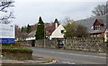
9
North entrance to Royal Alexandra Hospital
The road to Paisley's main hospital from Craw Road.
Image: © Stephen Sweeney
Taken: 29 Oct 2009
0.07 miles
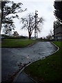
10
Paisley ambulance depot
Off Craw Road, at the Royal Alexandra Infirmary.
Image: © Thomas Nugent
Taken: 29 Feb 2016
0.07 miles