IMAGES TAKEN NEAR TO
Kames, TIGHNABRUAICH, PA21 2AG
Introduction
This page details the photographs taken nearby to PA21 2AG by members of the Geograph project.
The Geograph project started in 2005 with the aim of publishing, organising and preserving representative images for every square kilometre of Great Britain, Ireland and the Isle of Man.

There are currently over 7.5m images from over14,400 individuals and you can help contribute to the project by visiting https://www.geograph.org.uk
Image Map (Loading...)


Getting Data...Please wait
Leaflet Map data © OpenStreetMap
Images are licensed for reuse under creativecommons.org/licenses/by-sa/2.0
Notes
- Clicking on the map will re-center to the selected point.
- The higher the marker number, the further away the image location is from the centre of the postcode.
Image Listing (10 Images Found)
Images are licensed for reuse under creativecommons.org/licenses/by-sa/2.0
Image
Details
Distance
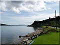
5
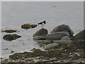
Oystercatcher on the rocks
Haematopus ostralegus at Kames.
Image: © M J Richardson
Taken: 12 May 2014
0.14 miles
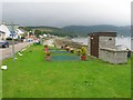
6
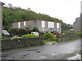
House at Cameron's Corner
I wonder if the architect won any awards?
Image: © M J Richardson
Taken: 12 May 2014
0.14 miles
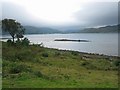
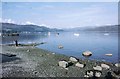
9
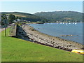
Kames: foreshore
Beach at the southern end of Kames village.
Image: © Chris Downer
Taken: 27 Jul 2008
0.18 miles
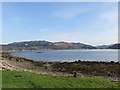
10
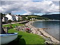
Kames: foreshore
Beach at the southern end of Kames village.
Image: © Elliott Simpson
Taken: 25 Aug 2010
0.18 miles