IMAGES TAKEN NEAR TO
Kingarth, ISLE OF BUTE, PA20 9PD
Introduction
This page details the photographs taken nearby to PA20 9PD by members of the Geograph project.
The Geograph project started in 2005 with the aim of publishing, organising and preserving representative images for every square kilometre of Great Britain, Ireland and the Isle of Man.

There are currently over 7.5m images from over14,400 individuals and you can help contribute to the project by visiting https://www.geograph.org.uk
Image Map
Images are licensed for reuse under creativecommons.org/licenses/by-sa/2.0
Notes
- Clicking on the map will re-center to the selected point.
- The higher the marker number, the further away the image location is from the centre of the postcode.
Image Listing (12 Images Found)
Images are licensed for reuse under creativecommons.org/licenses/by-sa/2.0
Image
Details
Distance
1
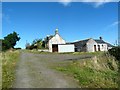
Lochend Farm - Isle of Bute
Lochend Farm
Image: © Raibeart MacAoidh
Taken: 1 Sep 2017
0.00 miles
2
Lochend Farm - Isle of Bute
Lochend Farm
Image: © Raibeart MacAoidh
Taken: 1 Sep 2017
0.00 miles
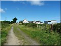
4

View over Loch Ascog
From the entrance to Little Grenach Farm, over Loch Ascog to High Bogany. The white-painted farm is Lochend.
Image: © Barbara Carr
Taken: 23 Apr 2009
0.09 miles
5
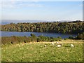
Sheep, Loch Hill
View towards Loch Ascog.
Image: © Richard Webb
Taken: 29 Sep 2013
0.15 miles
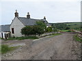
6
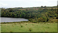
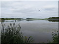
Loch Ascog
The south end of the loch at Lochend, viewed from the B881 road.
Image: © Thomas Nugent
Taken: 22 Aug 2024
0.16 miles
7
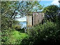
Loch Asgog - Isle of Bute
Bird hide at Loch Asgog
Image: © Raibeart MacAoidh
Taken: 1 Sep 2017
0.20 miles
8
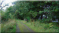
Track at Loch Ascog
A gated track at the south end of the loch.
Image: © Thomas Nugent
Taken: 22 Aug 2024
0.22 miles
9
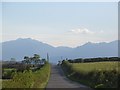
B881
View along a straight towards the hills of Arran.
Image: © Richard Webb
Taken: 29 Sep 2013
0.22 miles