IMAGES TAKEN NEAR TO
Newton Street, GREENOCK, PA16 8SJ

Introduction

This page details the photographs taken nearby to Newton Street, PA16 8SJ by members of the Geograph project.

The Geograph project started in 2005 with the aim of publishing, organising and preserving representative images for every square kilometre of Great Britain, Ireland and the Isle of Man.

There are currently over 7.5m images from over14,400 individuals and you can help contribute to the project by visiting https://www.geograph.org.uk

Image Map


Images are licensed for reuse under creativecommons.org/licenses/by-sa/2.0
Notes
  • Clicking on the map will re-center to the selected point.
  • The higher the marker number, the further away the image location is from the centre of the postcode.

Image Listing (90 Images Found)

Images are licensed for reuse under creativecommons.org/licenses/by-sa/2.0
  • ...
Image
Details
Distance
1
Ardgowan Street, Greenock
This photo was taken when I was tracing my husband's family tree - his grandfather was born here.
Image: © L J Cunningham Taken: Unknown
0.02 miles
2
Newton Street, Greenock
Between the nearest house on the right and the one next to it, a short street, Golf Place, branches off perpendicularly from this one. See Image for a nearby part of the road, as seen from a different angle. The present view is from near the southeastern tip of Lyle Park.
Image: © Lairich Rig Taken: 26 May 2018
0.03 miles
3
Greenock from the Lyle Hill
Image: © Tom Caldwell Taken: Unknown
0.05 miles
4
Inverclyde's waterfront
Garvel Point is prominent in this photo which was taken from Lyle Road at Newton Street, near Lyle Park. Parkhill Farm in the east end of Port Glasgow is visible in the distance.
Image: © Thomas Nugent Taken: 23 Jul 2010
0.05 miles
5
Newton Street, Greenock
Image: © Sandy Gemmill Taken: 24 Mar 2007
0.07 miles
6
Path from Lyle Road to Finnart Street
The view is from the upper end of the path, at about the point where Lyle Road becomes Image The descending path heads in this direction for about 70 metres, makes a left turn, and then continues for about 50 metres to reach Finnart Street.
Image: © Lairich Rig Taken: 26 May 2018
0.07 miles
7
Lyle Park
The park is on the northern side of Lyle Road. Earlier views: Image / Image / Image Taken on the same occasion as the present picture: Image / Image
Image: © Lairich Rig Taken: 14 Mar 2016
0.10 miles
8
Lyle Park
The park is beside Lyle Road, which appears on the left. Earlier pictures, see Image / Image / Image Taken on the same occasion as the present picture: Image / Image
Image: © Lairich Rig Taken: 14 Mar 2016
0.10 miles
9
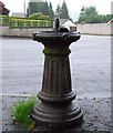
Old drinking fountain
An old cast iron drinking fountain on Newton Street at the junction with Madeira Street.
Image: © Thomas Nugent Taken: 18 Aug 2008
0.11 miles
10
Lyle Park
The area in the foreground is part of Lyle Park. The town of Helensburgh can be seen on the far shore of the Clyde. Taken on the same occasion as the present picture: Image Image For earlier views of the park, see Image / Image / Image The present picture bears out the comments made at the last of those links: The largest of the ships visible out in the Clyde is the container vessel Encounter, holding its position. Taking part in various manoeuvres around it throughout the afternoon were three mine countermeasure ships, two of which appear in the picture: the Hunt-class HMS Cattistock (M31), and the Sandown-class vessels HMS Blyth (M111), and (then out of shot to the left) HMS Grimsby (M108). The smaller vessel at the back is the SD Oronsay, Admiralty Fleet Tender. They had been calling in at Faslane and at Greenock's James Watt Dock, amongst other places.
Image: © Lairich Rig Taken: 14 Mar 2016
0.12 miles
  • ...