IMAGES TAKEN NEAR TO
Wellpark Buildings, GREENOCK, PA15 4QP
Introduction
This page details the photographs taken nearby to Wellpark Buildings, PA15 4QP by members of the Geograph project.
The Geograph project started in 2005 with the aim of publishing, organising and preserving representative images for every square kilometre of Great Britain, Ireland and the Isle of Man.

There are currently over 7.5m images from over14,400 individuals and you can help contribute to the project by visiting https://www.geograph.org.uk
Image Map
Images are licensed for reuse under creativecommons.org/licenses/by-sa/2.0
Notes
- Clicking on the map will re-center to the selected point.
- The higher the marker number, the further away the image location is from the centre of the postcode.
Image Listing (734 Images Found)
Images are licensed for reuse under creativecommons.org/licenses/by-sa/2.0
Image
Details
Distance
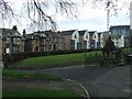
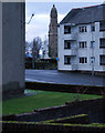
1
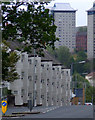
Regent Street
Viewed from Bank Street. The towerblocks are on Belville Street and are due for demolition.
Image: © Thomas Nugent
Taken: 28 Aug 2011
0.01 miles
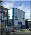
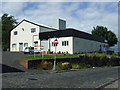
3
Britannia Halls
No doubting the loyalties within these walls.
Image: © Thomas Nugent
Taken: 28 Aug 2011
0.03 miles
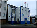
4
Terrace Road
The Britannia Halls building is on the right.
Image: © Thomas Nugent
Taken: 28 Aug 2011
0.03 miles
5
Lynedoch Street and Wellpark
Showing the well from which the park got its name.
Image: © Thomas Nugent
Taken: 28 Feb 2009
0.03 miles
6
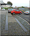
Metal track on Terrace Road
These metal plates were probably installed in the road to avoid damage to the cobbled road by heavily loaded carts being dragged up the hill from the docks or railway station to the sugar refineries and mills further up the hill. They would also provide a smoother ride for passengers or any fragile goods.
Image: © Thomas Nugent
Taken: 2 Nov 2015
0.03 miles
7
Metal track on Terrace Road
These metal plates were probably installed in the road to avoid damage to the cobbled road by heavily loaded carts being dragged up the hill from the docks or railway station to the sugar refineries and mills further up the hill. They would also provide a smoother ride for passengers or any fragile goods.
Image: © Thomas Nugent
Taken: 2 Nov 2015
0.03 miles
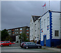
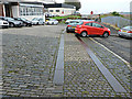
8
Terrace Road
A cobbled street with metal cart tracks. Bogle Street is to the right.
Image: © Thomas Nugent
Taken: 28 Aug 2011
0.03 miles
9
Victoria Tower
With the Mid Kirk tower and the Wellpark war memorial also visible. Viewed across Regent Street from Hill Street.
Image: © Thomas Nugent
Taken: 4 Dec 2012
0.04 miles
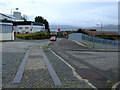
10
Terrace Road
I think this building used to house Orr's furniture shop.
Image: © Thomas Nugent
Taken: 3 Aug 2013
0.04 miles