IMAGES TAKEN NEAR TO
Station Road, PORT GLASGOW, PA14 6YB
Introduction
This page details the photographs taken nearby to Station Road, PA14 6YB by members of the Geograph project.
The Geograph project started in 2005 with the aim of publishing, organising and preserving representative images for every square kilometre of Great Britain, Ireland and the Isle of Man.

There are currently over 7.5m images from over14,400 individuals and you can help contribute to the project by visiting https://www.geograph.org.uk
Image Map (Loading...)


Getting Data...Please wait
Leaflet Map data © OpenStreetMap
Images are licensed for reuse under creativecommons.org/licenses/by-sa/2.0
Notes
- Clicking on the map will re-center to the selected point.
- The higher the marker number, the further away the image location is from the centre of the postcode.
Image Listing (51 Images Found)
Images are licensed for reuse under creativecommons.org/licenses/by-sa/2.0
Image
Details
Distance
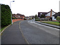
4
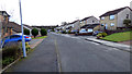
Seath Avenue
Off Douglas Avenue near Station Road.
Image: © Thomas Nugent
Taken: 27 Feb 2017
0.10 miles
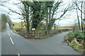
5

Seath Avenue
Off Douglas Avenue near Station Road.
Image: © Thomas Nugent
Taken: 27 Feb 2017
0.11 miles
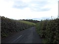
6

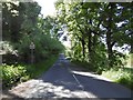
The road to Gleddoch House climbing out of Langbank
Image: © Alan Reid
Taken: 9 Sep 2013
0.14 miles
8

River Clyde
Looking across the fields above Langbank to Dumbarton. Kilpatrick Hills in the distance.
Image: © wfmillar
Taken: 7 Oct 2009
0.16 miles