IMAGES TAKEN NEAR TO
Kelburn Terrace, PORT GLASGOW, PA14 6SA
Introduction
This page details the photographs taken nearby to Kelburn Terrace, PA14 6SA by members of the Geograph project.
The Geograph project started in 2005 with the aim of publishing, organising and preserving representative images for every square kilometre of Great Britain, Ireland and the Isle of Man.

There are currently over 7.5m images from over14,400 individuals and you can help contribute to the project by visiting https://www.geograph.org.uk
Image Map (Loading...)


Getting Data...Please wait
Leaflet Map data © OpenStreetMap
Images are licensed for reuse under creativecommons.org/licenses/by-sa/2.0
Notes
- Clicking on the map will re-center to the selected point.
- The higher the marker number, the further away the image location is from the centre of the postcode.
Image Listing (119 Images Found)
Images are licensed for reuse under creativecommons.org/licenses/by-sa/2.0
Image
Details
Distance
1
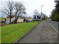
Glasgow Road
Looking east from Fyfe Park Terrace. A tenement stood between here and the distant billboard until the 1990, perhaps later.
Image: © Thomas Nugent
Taken: 17 Apr 2017
0.04 miles
2
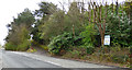
Glasgow Road
The west entrance road to Port Glasgow cemetery.
Image: © Thomas Nugent
Taken: 17 Apr 2017
0.04 miles
3
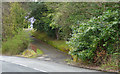
Road to Port Glasgow cemetery
The west entrance road to Port Glasgow cemetery off Glasgow Road.
Image: © Thomas Nugent
Taken: 17 Apr 2017
0.04 miles
4
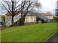
Fyfe Park footbridge
Crosses the Glasgow to Greenock and Wemyss Bay railway line between Glasgow Road and Kelburn Terrace, which can be seen on the other side of the line.
Image: © Thomas Nugent
Taken: 17 Apr 2017
0.05 miles
5
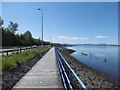
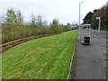
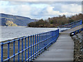
Kelburn Boardwalk, Port Glasgow
A path wedged between the A8 and Clyde.
Image: © Richard Webb
Taken: 2 Jun 2016
0.05 miles
6
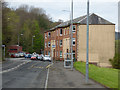
Glasgow Road
At Fyfe Park Terrace. This was the A8 until the mid 1980s.
Image: © Thomas Nugent
Taken: 17 Apr 2017
0.06 miles
7
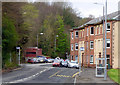
Fyfe Park Terrace
On Glasgow Road. This was the A8 until the mid 1980s.
Image: © Thomas Nugent
Taken: 17 Apr 2017
0.06 miles
8
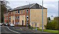
Fyfe Park Terrace
On Glasgow Road. This was the A8 until the mid 1980s. One of the Bay Street towerblocks can be seen on the right.
Image: © Thomas Nugent
Taken: 17 Apr 2017
0.06 miles
9
Riverside path at Port Glasgow
One of the ramps leading up from a concrete section to a boardwalk section.
Image: © Thomas Nugent
Taken: 8 Feb 2016
0.06 miles
10
Glasgow Road
At Fyfe Park footbridge which crosses the Glasgow to Greenock and Wemyss Bay railway line to Kelburn Terrace, which can be seen on the other side of the line.
Image: © Thomas Nugent
Taken: 17 Apr 2017
0.06 miles