IMAGES TAKEN NEAR TO
Dougliehill Road, PORT GLASGOW, PA14 5XF
Introduction
This page details the photographs taken nearby to Dougliehill Road, PA14 5XF by members of the Geograph project.
The Geograph project started in 2005 with the aim of publishing, organising and preserving representative images for every square kilometre of Great Britain, Ireland and the Isle of Man.

There are currently over 7.5m images from over14,400 individuals and you can help contribute to the project by visiting https://www.geograph.org.uk
Image Map
Images are licensed for reuse under creativecommons.org/licenses/by-sa/2.0
Notes
- Clicking on the map will re-center to the selected point.
- The higher the marker number, the further away the image location is from the centre of the postcode.
Image Listing (42 Images Found)
Images are licensed for reuse under creativecommons.org/licenses/by-sa/2.0
Image
Details
Distance
1
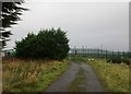
Access to a gated compound
I'm not sure what is beyond the fence but I suspect it may have something to do with Dougiehall Reservoir nearby.
Image: © Jonathan Thacker
Taken: 31 Oct 2017
0.05 miles
2
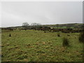
Cattle grazing near Dougliehill reservoir
Image: © Jonathan Thacker
Taken: 31 Oct 2017
0.08 miles
3
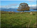
Grassland beside Dougliehill Road
The view is from Image The dark promontory at the far right, across the Clyde, is Ardmore Point. Left of centre, the Rosneath Peninsula is seen end-on.
Image: © Lairich Rig
Taken: 24 Oct 2016
0.10 miles
4
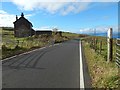
Dougliehill Road at West Dougliehill
Image: © Lairich Rig
Taken: 24 Oct 2016
0.12 miles
5
Dougliehill Road at West Dougliehill
Image: © Lairich Rig
Taken: 24 Oct 2016
0.13 miles
6
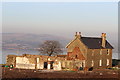
West Dougliehill
Derelict farm above Port Glasgow
Image: © Leslie Barrie
Taken: 18 Feb 2013
0.13 miles
7
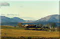
West Dougliehill Farm
With the Rosneath Peninsula beyond.
Image: © Thomas Nugent
Taken: Unknown
0.13 miles
8
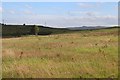
Grassland at West Dougliehill
Misty Law on the horizon
Image: © Alan Reid
Taken: 3 Aug 2013
0.16 miles
9
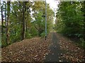
Path to Birkmyre Park from the cycle route
The path on the left is signposted as follows:
"Birkmyre Park
Port Glasgow ⅓ m"
Image: © Lairich Rig
Taken: 24 Oct 2016
0.19 miles
10
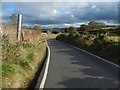
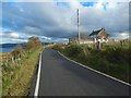
Dougliehill Road
The view is towards East Dougliehill, which, as the map shows, stands beside a sharp turn in the road.
Image: © Lairich Rig
Taken: 24 Oct 2016
0.19 miles