1
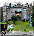
St John's RC Primary School
Recently extensively renovated.
Image: © Thomas Nugent
Taken: 8 Feb 2016
0.01 miles
2
St John's RC Primary School
The main door of the school on Glen Avenue. dated 1931.
See also
Image
Image: © Thomas Nugent
Taken: 8 Feb 2016
0.01 miles
3
New sports facilities at St John's Primary School
The new multi-sports compound looks out of place here in front of the school, but the cramped, sloping site provided few suitable options.
Image: © Thomas Nugent
Taken: 8 Feb 2016
0.02 miles
4
Greenock Road
New houses at the junction of Lower Mary Street. The Glasgow to Gourock & Wemyss Bay railway line is on the left. The line splits at this point, going straight ahead to Gourock and left and up the hill to Wemyss Bay.
Image: © Thomas Nugent
Taken: 25 Jan 2016
0.02 miles
5
St John's RC Primary School
The Glenburn Street side of the recently extensively renovated primary school which fronts onto Glen Avenue.
Image: © Thomas Nugent
Taken: 8 Feb 2016
0.03 miles
6
Glenpark House
The two distinct phases of the Category C Listed building http://portal.historic-scotland.gov.uk/hes/web/f?p=PORTAL:DESIGNATION:::::DES:LB46409 can be appreciated from this viewpoint in Glenburn Road.
Historic Scotland described it as follows, "As shown on the 1856 OS map, Glenpark was originally a simple rectangular-plan, 3-bay classical villa with a stair accessing an entrance centred in the front elevation. Subsequently enlarged and dwarfed by the later work, this original structure remains essentially intact - the giant order pilasters and finialled pediment being particularly good. The addition, itself well-detailed, is particularly notable for its polygonal tower. Although quirky, the juxtaposition of the two parts of Glenpark House is of interest, with elements working to tie them together to achieve an imaginative composition.".
Image: © Thomas Nugent
Taken: 8 Feb 2016
0.03 miles
7
Former A8 dual carriageway
Now reduced to a single two way carriageway, with new houses on the former west bound carriageway. The A8 now runs a few hundred metres further north.
Image: © Thomas Nugent
Taken: 8 Feb 2016
0.04 miles
8
Glenpark House
Viewed from Glenburn Street.
Image: © Thomas Nugent
Taken: 8 Feb 2016
0.04 miles
9
New houses at The Glen
Greenock Road at Lower Mary Street (on the right).
Image: © Thomas Nugent
Taken: 25 Jan 2016
0.04 miles
10
Lower Mary Street
Mary Street proper is beyond the railway arch which carries the Glasgow to Gourock & Wemyss Bay line. Note the Wemyss Bay Line junction signal on the extreme right.
Image: © Thomas Nugent
Taken: 7 Jul 2013
0.04 miles


