IMAGES TAKEN NEAR TO
KILMACOLM, PA13 4TF
Introduction
This page details the photographs taken nearby to PA13 4TF by members of the Geograph project.
The Geograph project started in 2005 with the aim of publishing, organising and preserving representative images for every square kilometre of Great Britain, Ireland and the Isle of Man.

There are currently over 7.5m images from over14,400 individuals and you can help contribute to the project by visiting https://www.geograph.org.uk
Image Map
Images are licensed for reuse under creativecommons.org/licenses/by-sa/2.0
Notes
- Clicking on the map will re-center to the selected point.
- The higher the marker number, the further away the image location is from the centre of the postcode.
Image Listing (15 Images Found)
Images are licensed for reuse under creativecommons.org/licenses/by-sa/2.0
Image
Details
Distance
1
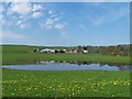
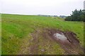
Pond at Blackwater Farm
Blackwater Farm is on the boundary of the square.
Image: © Thomas Nugent
Taken: 11 May 2006
0.05 miles
2

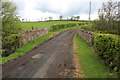
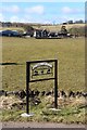
Bridge over Blacketty Water
The bridge leads to Blackwater farm.
Image: © Thomas Nugent
Taken: 11 May 2006
0.09 miles
3

Blackwater Farm
The pond has dried up since my previous visit in May 2006 Image
Image: © Thomas Nugent
Taken: 1 May 2020
0.09 miles
5
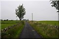
Blackwater Bridge
Gateside Road crossing Blacketty Water.
Image: © Thomas Nugent
Taken: 1 May 2020
0.13 miles
8
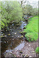
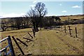
Blacketty Water
Looking downstream from the bridge at Gateside Road.
Image: © Thomas Nugent
Taken: 1 May 2020
0.15 miles