IMAGES TAKEN NEAR TO
KILMACOLM, PA13 4RP
Introduction
This page details the photographs taken nearby to PA13 4RP by members of the Geograph project.
The Geograph project started in 2005 with the aim of publishing, organising and preserving representative images for every square kilometre of Great Britain, Ireland and the Isle of Man.

There are currently over 7.5m images from over14,400 individuals and you can help contribute to the project by visiting https://www.geograph.org.uk
Image Map
Images are licensed for reuse under creativecommons.org/licenses/by-sa/2.0
Notes
- Clicking on the map will re-center to the selected point.
- The higher the marker number, the further away the image location is from the centre of the postcode.
Image Listing (7 Images Found)
Images are licensed for reuse under creativecommons.org/licenses/by-sa/2.0
Image
Details
Distance
4
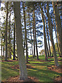
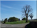
Larch Trees, Kilmacolm
Kilmacolm War Memorial can be spotted beyond the trees.
Image: © wfmillar
Taken: 7 Oct 2009
0.24 miles
5
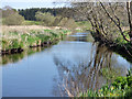
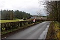
The River Gryffe
Looking downstream at Pacemuir Bridge, Kilmacolm.
Image: © Thomas Nugent
Taken: 12 May 2016
0.24 miles
6
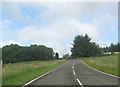
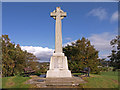
Kilmacolm war memorial
Near the B788 - B786 road junction, south of the village.
Image: © Thomas Nugent
Taken: 11 May 2006
0.24 miles
7
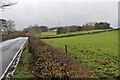
War Memorial, Kilmacolm
Kilmacolm in the distance.
Image: © wfmillar
Taken: 7 Oct 2009
0.24 miles