IMAGES TAKEN NEAR TO
Camphill, PAISLEY, PA1 2HJ
Introduction
This page details the photographs taken nearby to Camphill, PA1 2HJ by members of the Geograph project.
The Geograph project started in 2005 with the aim of publishing, organising and preserving representative images for every square kilometre of Great Britain, Ireland and the Isle of Man.

There are currently over 7.5m images from over14,400 individuals and you can help contribute to the project by visiting https://www.geograph.org.uk
Image Map
Images are licensed for reuse under creativecommons.org/licenses/by-sa/2.0
Notes
- Clicking on the map will re-center to the selected point.
- The higher the marker number, the further away the image location is from the centre of the postcode.
Image Listing (79 Images Found)
Images are licensed for reuse under creativecommons.org/licenses/by-sa/2.0
Image
Details
Distance
1
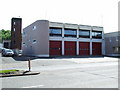
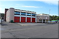
Paisley Fire Station
On Canal Street. See also Image
Image: © Thomas Nugent
Taken: 22 May 2007
0.10 miles
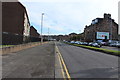
2
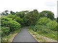
Paisley Canal Line
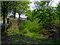
The closed section between Paisley Canal Station and Johnstone, now a cycle path. (National Cycle Route 7 and 75)
Image: © Richard Webb
Taken: 16 Jun 2009
0.11 miles
4
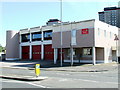
Paisley Fire Station
On Canal Street. See also Image
Image: © Thomas Nugent
Taken: 22 May 2007
0.13 miles
5
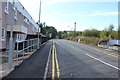
Car wash, Canal Street
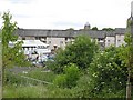
Car washing in a yard off Canal Street, Paisley. View towards the city centre from a disused railway, now a cycle path.
Image: © Richard Webb
Taken: 16 Jun 2009
0.13 miles
8
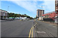
Former trackbed of the paisley canal Line
George Street is over the wall to the left.
Image: © Thomas Nugent
Taken: 29 Apr 2011
0.16 miles
10
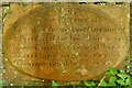
Castlehead churchyard: plot marker
This is one of the stones set in the churchyard's southern boundary wall (Image); the other stones are the same shape, and their inscription follows much the same pattern.
"No 583 is the Property of Gavin Lambie and Janet Cumming his Spouse and their heirs; Here lie the remains of James Lambie aged 4 years and Janet Lambie aged 2 years their Children who died the 13th Nov'r 1805."
Image: © Lairich Rig
Taken: 20 May 2013
0.16 miles