IMAGES TAKEN NEAR TO
Clare, THAME, OX9 7HQ
Introduction
This page details the photographs taken nearby to OX9 7HQ by members of the Geograph project.
The Geograph project started in 2005 with the aim of publishing, organising and preserving representative images for every square kilometre of Great Britain, Ireland and the Isle of Man.

There are currently over 7.5m images from over14,400 individuals and you can help contribute to the project by visiting https://www.geograph.org.uk
Image Map
Images are licensed for reuse under creativecommons.org/licenses/by-sa/2.0
Notes
- Clicking on the map will re-center to the selected point.
- The higher the marker number, the further away the image location is from the centre of the postcode.
Image Listing (12 Images Found)
Images are licensed for reuse under creativecommons.org/licenses/by-sa/2.0
Image
Details
Distance
1
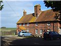
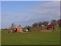
Hamlet House, Clare
Formerly a single farmhouse but now two cottages and dating from the turn of the 16th/17th centuries.
Image: © Andrew Smith
Taken: 1 Mar 2008
0.06 miles
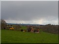
2
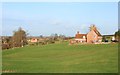
North Farm, Clare
The hamlet of Clare comprises a few cottages and two farms, imaginatively called
North and South.
The footpath between them is pretty much undefined at this point, Just ramble across the grass to the far corner.
Image: © Des Blenkinsopp
Taken: 27 Jan 2012
0.09 miles
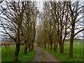
3
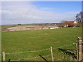
South Farm, Clare
Clare sits on a low ridge and is positioned at the top of its northern flank, giving it a good view over the Thame valley.
Image: © Andrew Smith
Taken: 1 Mar 2008
0.11 miles
5
North Farm, Clare
Approaching on the footpath between Clare and Stoke Talmage. The barn is being held up by its contents of bales.
Image: © Andrew Smith
Taken: 1 Mar 2008
0.12 miles
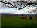
6
North Farm, near Clare
Didcot power station is visible in the far distance through the rain.
Image: © Bikeboy
Taken: 23 Mar 2014
0.14 miles
8
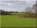
Farmland, Clare
Areas of woodland amongst pastures midway between Clare and Stoke Talmage.
Image: © Andrew Smith
Taken: 1 Mar 2008
0.16 miles
9
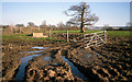
Squelch Hazard
The footpath to Clare runs beside the fence, but there's an unofficial diversion needed here.
Image: © Des Blenkinsopp
Taken: 27 Jan 2012
0.17 miles
10
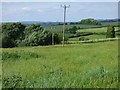
Farmland, Pyrton
The hillside descending northwards from Clare.
Image: © Andrew Smith
Taken: 22 May 2019
0.17 miles