IMAGES TAKEN NEAR TO
Icomb Road, CHIPPING NORTON, OX7 6XJ
Introduction
This page details the photographs taken nearby to Icomb Road, OX7 6XJ by members of the Geograph project.
The Geograph project started in 2005 with the aim of publishing, organising and preserving representative images for every square kilometre of Great Britain, Ireland and the Isle of Man.

There are currently over 7.5m images from over14,400 individuals and you can help contribute to the project by visiting https://www.geograph.org.uk
Image Map (Loading...)


Getting Data...Please wait
Leaflet Map data © OpenStreetMap
Images are licensed for reuse under creativecommons.org/licenses/by-sa/2.0
Notes
- Clicking on the map will re-center to the selected point.
- The higher the marker number, the further away the image location is from the centre of the postcode.
Image Listing (10 Images Found)
Images are licensed for reuse under creativecommons.org/licenses/by-sa/2.0
Image
Details
Distance
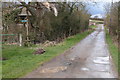
2
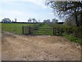
Footpath meets track
The footpath from Icomb meets the track, also a public bridleway, serving Pebbly Hill Barn.
Image: © Michael Dibb
Taken: 9 Apr 2011
0.02 miles
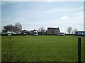
3
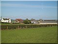
Pebbly Hill Farm
Seen from the footpath.
Image: © Michael Dibb
Taken: 9 Apr 2011
0.04 miles
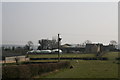
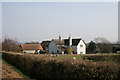
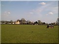
4
Pebbly Hill Farm
Included in the farm buildings is a manufacturer of products for disabled people. The track, a public bridleway, also serves a nursery and a camping/caravan site. Seen from the minor road.
Image: © Michael Dibb
Taken: 9 Apr 2011
0.04 miles
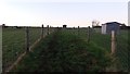
7
Camping ground at Pebbly Hill
Seen from the footpath is this small camping/caravan site.
Image: © Michael Dibb
Taken: 9 Apr 2011
0.06 miles
8
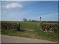
Bridleway leaves road
Near to Pebbly Hill Farm, this bridleway leaves the minor road and ascends Pebbly Hill, heading towards Jay Farm and the B4450 road.
Image: © Michael Dibb
Taken: 9 Apr 2011
0.07 miles
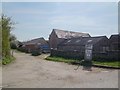
9
Pebbly Hill Barn
The 1:25,000 OS map has the name of the location as Pebbly Hill Barn. There now appears to be much more than a barn there.
Image: © Michael Dibb
Taken: 9 Apr 2011
0.14 miles
10
Bridleway heading up Pebbly Hill
From Pebbly Hill Farm the bridleway heading up Pebbly Hill
Image: © Shaun Ferguson
Taken: 4 Dec 2019
0.18 miles