IMAGES TAKEN NEAR TO
Stow Road, CHIPPING NORTON, OX7 6HR
Introduction
This page details the photographs taken nearby to Stow Road, OX7 6HR by members of the Geograph project.
The Geograph project started in 2005 with the aim of publishing, organising and preserving representative images for every square kilometre of Great Britain, Ireland and the Isle of Man.

There are currently over 7.5m images from over14,400 individuals and you can help contribute to the project by visiting https://www.geograph.org.uk
Image Map (Loading...)


Getting Data...Please wait
Leaflet Map data © OpenStreetMap
Images are licensed for reuse under creativecommons.org/licenses/by-sa/2.0
Notes
- Clicking on the map will re-center to the selected point.
- The higher the marker number, the further away the image location is from the centre of the postcode.
Image Listing (34 Images Found)
Images are licensed for reuse under creativecommons.org/licenses/by-sa/2.0
Image
Details
Distance
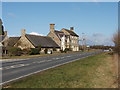
2
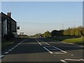
Workham Lane
Leaving the A424 Stow-on-the-Wold to Burford road alongside the Merrymouth Inn, the lane passes Workham Farm and runs to Little Rissington Airfield. The repairs are overrunning somewhat.
Image: © Michael Dibb
Taken: 27 Nov 2011
0.01 miles
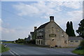
3
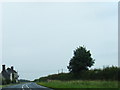
A424 at The Merrymouth Inn
Judging by the number of cars parked in late afternoon, a popular establishment.
Image: © Peter Whatley
Taken: 15 Oct 2011
0.01 miles
4
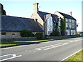
The Merrymouth Inn
Situated alongside the A424 Stow-on-the-Wold to Burford Road, the inn offers food and accommodation as well as refreshments.
Image: © Michael Dibb
Taken: 27 Nov 2011
0.01 miles
5
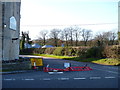
Merrymouth Inn, near Fifield
Named as "Merry Mouth Inn" on the Ordnance Survey map. This inn standing alone on the road from Burford to Stow dates back to the 13th century. It appears in many guides to pubs and restaurants for the area.
Image: © David Hawgood
Taken: 1 Mar 2006
0.01 miles
6
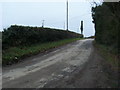
Seven Shires Way
Seven Shires Way on lane up from Workham Farm towards the A424
Image: © Shaun Ferguson
Taken: 20 Feb 2011
0.02 miles
7
The Merrymouth Inn
Comfortable accommodation in converted stables and 3 good beers to sample.
Image: © Bill Boaden
Taken: 25 Jun 2009
0.03 miles
8
Horse at Workham Farm
As I parked here for my walk this horse sidled over and said "take my photo". I could have made a better job of it though.
Image: © Graham Horn
Taken: 15 Sep 2012
0.04 miles
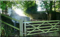
9

Byway leaves the lane
The restricted byway leaves the lane at the rear of the Merrymouth Inn and, after descending to cross Coombe Brook, runs up the hill towards Little Rissington Airfield.
Image: © Michael Dibb
Taken: 27 Nov 2011
0.05 miles
10

Restricted byway at Workham Farm
Further along its status changes to bridleway. It is a lovely route, probably underused because a mile ahead the paths on the Gloucestershire side have been extinguished by Little Rissington airfield.
Image: © Graham Horn
Taken: 15 Sep 2012
0.05 miles