IMAGES TAKEN NEAR TO
Cow Lane, CHIPPING NORTON, OX7 4AU
Introduction
This page details the photographs taken nearby to Cow Lane, OX7 4AU by members of the Geograph project.
The Geograph project started in 2005 with the aim of publishing, organising and preserving representative images for every square kilometre of Great Britain, Ireland and the Isle of Man.

There are currently over 7.5m images from over14,400 individuals and you can help contribute to the project by visiting https://www.geograph.org.uk
Image Map
Images are licensed for reuse under creativecommons.org/licenses/by-sa/2.0
Notes
- Clicking on the map will re-center to the selected point.
- The higher the marker number, the further away the image location is from the centre of the postcode.
Image Listing (17 Images Found)
Images are licensed for reuse under creativecommons.org/licenses/by-sa/2.0
Image
Details
Distance
1
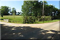
Trimmed trees at the entrance to Badgers Farm
Image: © Philip Jeffrey
Taken: 13 Jun 2021
0.08 miles
2
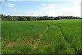
Farmland looking towards Badgers Farm
Image: © Philip Jeffrey
Taken: 13 Jun 2021
0.10 miles
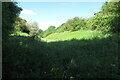
4
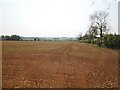
Valley view
Looking across the recently ploughed field and over the valley of the River Swere.
Image: © Michael Dibb
Taken: 30 Apr 2011
0.12 miles
5
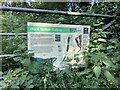
Nature reserve notice at Hook Norton Cutting
Image: © Philip Jeffrey
Taken: 13 Jun 2021
0.13 miles
7
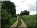
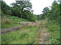
Track to a shed
Alongside the former Kington to Banbury railway line.
Image: © Jonathan Thacker
Taken: 14 Jun 2017
0.13 miles
8
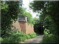
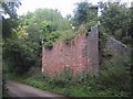
Bridge abutment
Formed part of a bridge on the Kingham to Banbury railway line which closed to freight traffic at this point in 1958, passenger services having ceased in 1951.
Image: © Jonathan Thacker
Taken: 14 Jun 2017
0.14 miles
9
Overgrown disused railway bridge abutment
Image: © Sarah Charlesworth
Taken: 25 Aug 2009
0.14 miles
10
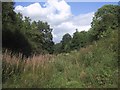
The overgrown Hook Norton cutting
Image: © Sarah Charlesworth
Taken: 25 Aug 2009
0.16 miles