IMAGES TAKEN NEAR TO
Watlington Road, WATLINGTON, OX49 5DS
Introduction
This page details the photographs taken nearby to Watlington Road, OX49 5DS by members of the Geograph project.
The Geograph project started in 2005 with the aim of publishing, organising and preserving representative images for every square kilometre of Great Britain, Ireland and the Isle of Man.

There are currently over 7.5m images from over14,400 individuals and you can help contribute to the project by visiting https://www.geograph.org.uk
Image Map
Images are licensed for reuse under creativecommons.org/licenses/by-sa/2.0
Notes
- Clicking on the map will re-center to the selected point.
- The higher the marker number, the further away the image location is from the centre of the postcode.
Image Listing (4 Images Found)
Images are licensed for reuse under creativecommons.org/licenses/by-sa/2.0
Image
Details
Distance
1
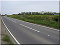
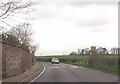
Watlington Road
Watlington Road passing Shirburn Farm
Image: © Shaun Ferguson
Taken: 3 May 2008
0.12 miles
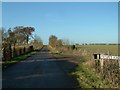
3
B4009 around the walls of Shirburn Castle estate
Image: © John Firth
Taken: 4 Apr 2014
0.23 miles
4
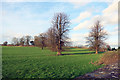
Over the wall in Shirburn Park
Shirburn Park is behind a substantial stone wall along here, but this is what there is to see on the other side.
Not a lot. A few trees and some ridge and furrow.
Image: © Des Blenkinsopp
Taken: 29 Dec 2015
0.24 miles